Road Trip ! Road Trip !
August 17th to September 8th 2002
Our longest ever holiday together, driving a grand tour around the Southwestern United States starting from San Francisco and taking in the Sierra Nevada mountains, the Mojave Desert, Southern Utah, Northern Arizona and the California Coast. Here are our adventures.
San Francisco
Golden Gate
Alcatraz
Born to be Wild
Yosemite
Mammoth Mountain
Death Valley
Scotty's Castle
Hoover Dam
Zion
Bryce Canyon
Capitol Reef
Natural Bridges
Monument Valley
Grand Canyon
Wupatki National Monument
Petrified Trees
Lake Havasu City
Joshua Tree National Park
Ventura
Hearst Castle
Pacific Grove
San Francisco Airport
- Preparations
- San Francisco
- Golden Gate
- Alcatraz
- Born to be Wild
- Yosemite
- Over the Top
- Death Valley
- Not Las Vegas
- Hoover to Zion
- Zion to Bryce
- Bryce to Capitol
- Bridges & Cliffs
- Monumental
- Grand Canyon
- Flagstaff
- Petrified Trees
- Too Much Driving
- Joshua Tree
- Joshua Again
- Freeway Frenzy
- Highway 1
- Monterey
- The Final Leg
Preparations

Thinking in Advance
So, we’d planned a fly-drive but hadn’t planned any specific route. So what preparations are required for a fly-drive in the USA? Especially when you haven’t decided where to go or what to do?
Pre-Cursors
-
Somewhere to stay on your first night – We figured we’d pre-book somewhere in San Francisco prior to departure, so that we didn’t have to search around in an exhausted stupor when we arrived, and (partly) because it is easy to find reasonable deals on nice hotels in San Francisco. We chose a special deal at the Westin St Francis from a random travel website (take your pick).
-
Some means of transport when you leave your first location – We pre-booked a car through Holiday Autos ( www.holidayautos.co.uk ), to get a known price for a known package – no shocks wanted on check-in. Holiday Autos did a fine job. They were easy to use and they gave a standard contract. It included everything you could ever want up front, no surprises.
Entertainment
-
A target list of places to go – We drew up a wish list of places primarily from the National Parks Service website ( http://www.nps.gov ).
-
A map and some tour books, so you know where the target places are – Many thanks to Moon Travel Handbooks ( www.moon.com ), without whose invaluable guides we wouldn’t have known where to go or what we were looking at, although we would have had a lot more space in our luggage. And many thanks also to Rand McNally ( www.randmcnally.com ), without whose tremendous road atlas of the USA, we wouldn’t have got far outside San Francisco.
-
Advance booked tickets for anything really busy – We pre-purchased tickets for the Alcatraz ferry trip from Blue and Gold Fleet ( http://www.blueandgoldfleet.com ) as these tend to sell out pretty quickly.
Administrative Stuff
-
A bunch of documentation – There’s no point in saying what you need by way of visa, insurance and the like. Things change. So check with your airline. Buy some good insurance which covers everything you take with you, including yourself. In the USA you don’t get a lot of medical help unless you can pay. We bought an annual worldwide policy through American Express. Their policies are useful because they give a card to carry. Hospitals take that on trust without demanding immediate payment with your credit card.
-
Some means of supporting yourself – In fact, take lots of different types. We took a selection of different denomination dollar banknotes, some American Express dollar traveller’s cheques and a stack of credit cards and debit cards. Remember to take only dollar denominated traveller’s cheques. Not that we sanction use of particular organizations, but American Express ones work best in the USA. At one point I asked someone if they wanted ID with the traveller’s cheque and was told that the American Express logo on the cheque was all that was needed. This wouldn’t happen with other brands.
-
Oh, and don’t forget your passport
- Or your toothbrush
San Francisco
Flying to San Francisco
There’s not much to say really. We got up a bit early, drove to Heathrow, stood in several queues and eventually got on one of BA’s finest big aeroplanes bound for San Francisco. 10 hours of flying later and it was still only mid-afternoon when we arrived. Oh yes, jet lag!
San Francisco airport was uneventful, as was the taxi ride downtown. We had one of those American big city moments. Miles and miles of suburbs and wide roads, then suddenly your view is blocked out by all these big buildings that someone very thoughtlessly left in the way. Downtown San Francisco just rises out of the suburbs. So we arrived at our hotel, the Westin St Francis ( http://www.westinstfrancis.com/ ) on Union Square. Right in the middle of downtown, and certainly deep in the middle of the one way system.
 We were both equally excited and tired. We were looking forward to a quiet dinner and some sleep prior to our first day of actual holiday. However, the hotel room wasn’t ready so we lounged for an hour or so in the lounge, drank some drinks, nibbled some nibbles and listened to a jolly nice chap tickling the ivories ( he was fairly friendly with the ebonies as well ).
Is it Time for Dinner Yet?
Suitably checked into our room, we were slightly disappointed with the lack of view, but I guess that’s the downside of cheap deals – someone has to fill the not-so-plush rooms. Undaunted, we snoozed for a bit and then got ready to find that nice quiet, simple dinner.
A couple of blocks round the corner was a sort of Italian bistro place. It was quite possibly Puccini & Pinetti at 129 Ellis St ( http://www.pucciniandpinetti.com ). It wasn’t quiet, and we didn’t get a table, we sat at the bar, but the service was good, the beer was cold and wet and the food was very good. There were loads people and it was as good an introduction to San Francisco as you could want. So all in all, dinner made up for the long day spent sitting in a big metal tube. We went to bed, even though it was only about 9 pm. Our bodies thought it was six in the morning, so it was about time for some zzzzzzzzzzzzzzzs really.
Golden Gate
Open the photo gallery >>
The First Day
Isn’t the weather in San Francisco bizarre ? It’s 60oF and this is a mini heatwave, apparently. We were warmer at home. Anyway, it’s sunny and there aren’t any clouds, so it can’t be that bad. We dressed for a summer day and headed off to find out what San Francisco has to offer the recently arrived tourist. We were sort of hoping to make it to the Golden Gate Bridge, but hadn’t thought far beyond that.
 Before any actual touristing, we needed some breakfast. We tried a little coffee shop on the corner of Powell and Sutter. This was our first introduction to the American concept of choice in its full glory. We spent ages holding up the queue while we were working our way through the substantial menu. We can’t remember the name of the place but whatever it was, the home made granola was excellent, and the muffins amazing ( especially the chocolate ones ). Translating the various forms of milk into English from American was the next challenge. Once we’d established that half-fat = semi-skimmed, we were well away.
Retail Therapy
Suitably stuffed, we began the next phase. It was shopping that we might have done at home, but thought might be cheaper in the US. Kas wanted a telephoto lens for her Minolta, and I wanted a wide-angle zoom for my Canon. Some trudging was done in the downtown area, and a number of suitable emporia were located. However, the huge price savings promised on several websites proved to be entirely fictional. We were also hit by the American practice of showing a price on the labels and then adding on the tax afterwards. It’s not that this is a bad practice, or a particularly shabby one. It’s just that we Brits get used to the labelled price being the same as the amount you pay. And it’s a bit confusing when Americans do it differently.
Eventually we both got what we wanted for. It was about the same price we would have paid back home, so I suppose we ended up neither winning nor losing. It occupied a portion of the morning with an essential learning experience which proved useful in the following three weeks.
 So another return to the hotel to pack the camera bags with our new goodies, and off to explore the city.
Walking Time
Being British, and seeing as it wasn’t actually raining, we decided to explore on foot. We walked over through Chinatown and just sort of kept going downhill all the way to Fisherman’s Wharf.
Did we have lunch somewhere here? Neither of us can really remember. However, we did go into a tourist information office and ask about buses to the Golden Gate Bridge. The guy thought we were insane because we walked from downtown. Really though? It’s only a couple of miles and most of it is downhill . OK, so the walk isn’t the most prettified, touristy part of the city, but we’ve been to worse, and anyway, you have to pass through the average, quiet, residential bits to truly to appreciate the spectacular bits. We then walked several blocks trying to find a bus going towards the Golden Gate Bridge. We passed Fort Mason, and then drifted around a bit until we found a very helpful local lady who advised on how to pay for the bus.
The Bridge
By the time we got to the end of Golden Gate, we had descended into a blanket of fog. And it was cold. As we were both dressed for summer, we decided that trying to walk across the whole of the bridge wasn’t the brightest idea in the world, so we just walked ( quickly ) over to the first tower and took a few arty photos of bridge, fog and wind. The wind on the bridge was strong enough to be photographed.
 Another bus was caught and we found ourselves back in the sunshine, and back at Jackson Square, which we had passed on our great downhill hike that very morning.
Is that a Hill?
At this point, both of us needed to be reintroduced to the warmer, caffeine and calorie-laden aspects of American life, so a small independent coffee shop on the corner was too much to resist. OK, so we didn’t exactly try to resist very much.
Whilst drinking our skinny lattes and munching on our sticky cakes, we discussed the plans for the rest of the afternoon. Just outside, Coit Tower looked very close, and yet somehow on top of a very large hill. Undaunted by our earlier experiences and suitably warmed and refuelled we decided that we might as well climb the hill on foot. Public transport seemed convoluted and we both had good sensible shoes on, so off we went.
Tell you what, it was chuffin’ steep going up that hill, but our decision to walk up proved sound as we turned a corner and were greeted by a large queue of cars, buses and other malcontents trying to get up into the rather small car park. Maybe the occupants had actually just abandoned their vehicles halfway up the hill and decided to walk. There wasn’t much evidence of motion.
So we went up into the vaguely phallic thing and attempted to take photos of the downtown skyline, but the Perspex windows and general haziness outside meant that the photo shop had a devil of a job getting the prints to look good. Doh!
We then rounded off the afternoon with some more walking, this time trying to find a criss-cross route down the hill, up through Chinatown and back to Union Square. The walk was a bit smelly and sticky and busy, but we got home eventually.
Time for Dinner
Dinner was provided at a random location in Chinatown , selected by the tried and trusted technique of looking at the window menu, and peering through the window to ensure that there were enough people for it to be good, but not enough to make us wait ages for a table. From what we remember, the food was good and the beer was cold and wet. We felt satisfied with our first day’s efforts. Satisfied enough that we retired to our room without a view for a much-needed snooze.
Alcatraz
Open the photo gallery >>
Stocking Up on Breakfast
We woke up to another grey and cold-looking day. This time, the overcast windy conditions reached inland to downtown as well. We might as well have stayed at home. But undeterred, we both donned long trousers and long-sleeved shirts before venturing out. Today was our much-anticipated trip to Alcatraz.
 Breakfast was consumed at the (apparently very famous) Sears just up the road at Powell and Sutter, and once we were suitably stocked up on bacon, pancakes and coffee it was time to hop onto one of those cable car thingies and head off to prison for the main event of the day. After a further short break for coffee, and photographing seals at Fisherman’s Wharf, we jumped on one of Blue and Gold’s finest for the trip over to Alcatraz. A cautionary note to future travellers – if you take this boat on a cloudy windy day, don’t go on the upper deck, it’s cold.
Doing Time
And there we were at Alcatraz ( www.nps.gov/alca/ ), one of the most infamous prisons ever built, and the setting for many a good film staring Clint Eastwood and Tyne Daly. I have to admit that the actual prison part was slightly smaller than expected. But we felt the self-guided interpretive tour was well worth the few pennies it cost to rent the headset. Our retrospective view of the place is further enhanced by the fact that Kev only took photos in black and white. Somehow the place comes out better in black & white, and it suited the grey and cold conditions perfectly.
After the tour we toyed with the idea of walking round further bits of the island, but quite frankly, we were freezing, so we opted for the wimp’s option of catching the ferry back and engaging in some retail therapy at Pier 39 instead. This began with a jolly nice warming drink and lardy lunch. It culminated with Kas buying a big hat. This was in anticipation of us moving on to somewhere where there would be enough sunshine to justify an avoidance strategy.

The Tourist Trap
Next stop was that top tourist trap known as Lombard Street. More specifically, that bit of Lombard Street that has the bends in it. Surprisingly enough, loads of other people were walking or driving down it at the same time as us. Most inconsiderate of them, spoiling our photos like that.
At this point we reached a difficult juncture in the day. It was too early to go back to the hotel, and too late to head off anywhere else of substance. So we plumped for a bus back downtown to investigate photographic opportunities offered by the larger buildings there. Obviously, any good photographic expedition needs to be meticulously planned, especially when you’re cold. We planned it by renewing our acquaintance with the Starbucks organization ( www.starbucks.com ) at one of their many sites downtown. This one was in the shadow of the Transamerica Pyramid, and we were less than surprised to discover they had exactly the same coffee menu as the ones back home, although the selection of cakes, cookies and other foodstuffs was different.
The best photographic positions seemed to be the Transamerica Pyramid and 101 California Street. At the latter, Kas seriously asked a woman standing at the bus stop if she wouldn’t mind standing slightly further to her right, so that she was out of shot. Cheeky madam!
Retro Dining
Having satisfied our photographic desires it was sufficiently late to go back to the hotel for beer, snoozing and a clean-up before heading off for a well-earned dinner. This night we chose a retro-American themed diner on Powell called Lori’s ( www.lorisdiner.com ) just one block south of Union Square. It’s apparently very famous. What we remember about the place is some top-notch American burgers and a room full of genuine retro American icons. Once again the food was good and plentiful and the beer was cold and wet.
Born to be Wild
Open the photo gallery >>
Get Your Motor Runnin’
And so arrived the day when we would leave the big city and head for the countryside. Wouldn’t you just know it, the sun was out. Not a cloud in the sky and getting warm already. Typical! I guess that makes it perfect weather to head out on the highway, looking for adventure and whatever comes our way. We were born to be wild! Have I milked the 1969 motorcycle counter-culture thing sufficiently yet?
 We started our day with more homemade granola and chocolate muffins at the place on the corner of Powell and Sutter and prepared for the always entertaining game of collecting the rental car. The usual game is to guess what upgrades the guy is going to try to sell you. In this case, Holiday Autos ( www.holidayautos.co.uk ) had got us a deal with Hertz to collect from their downtown office, which was conveniently just up the road from the hotel.
When the nice man from Hertz realized we had already bought all the possible options for upgraded insurance he was left with no choice but to try to sell us a bigger car. His main line of argument was that we’d never get the luggage in the car we’d booked. So he suggested we upgrade from a standard to full-size saloon/sedan. This didn’t seem to give us any advantage. The next option was a 4×4 for the same price as the full-size sedan. Oh, go on then, just this once. At about $5 a day extra it’s hardly worth even talking about it.
Head Out on the Highway
And behold, a nice new Toyota RAV4 was ours, with unlimited mileage and insurance against everything except abduction by aliens. One downside – it had only just come back in, so they cleaned it but hadn’t filled up with fuel. In fact, the gauge was so low that the engine nearly cut out going up hills. Thankfully, however, both the hotel ( and luggage ) and the freeway were downhill, as was the closest available gas station as advised by the valet at the Westin.
So came the first of very many stops at gas stations, to fill up with motion lotion and stock up on essential freeway consumables like Pringles and Coke. We might have got something healthy like sandwiches as well, but those have been purged from the memory. Just round the corner was the access ramp up to I-80, and Kas’s first experience of my driving in the USA. Over the Bay Bridge and in to Oakland, a few bits of shuffling and I-580 beckoned us away from the suburbs and into farming country.
No time to linger though, because we had an urgent appointment with the National Park Service ( www.nps.gov ), and more specifically with Yosemite ( www.nps.gov/yose ), home of the famous cartoon character called Sam, and life’s work for the guy who invented landscape photography, Ansel Adams. It was a slow ride up Highway 120 into the park, followed by a brief stop at the entrance gate to buy our NPS annual pass – a great idea for this kind of holiday, as one fee gets you into any NPS site, for any number of times for a whole year after the date of issue. And you can buy them at the entrance station to Yosemite. Formalities complete, so bring on the landscapes!
Looking for Adventure
Nothing prepares you for the beauty you encounter as you enter the Yosemite Valley, not even the helpful NPS website ( www.nps.gov/yose/ ). Sheer granite cliffs rise up 4000 feet from the green meadows on the valley floor. Waterfalls cascade over various precipitous drops. It’s just Spectacular with a capital S. If we had the cash we would jack it all in and move up here. We can fully understand why Ansel Adams never tired of the place.
However, you do get plenty of opportunity to look at the scenery as you drive in seemingly endless loops and sub-loops around the one-way system on the valley floor. Watch the signs folks, or you end up on a 10-mile loop to get back to somewhere which is 200 yards behind you. Either that or just plan your route in advance.
 First stop, late lunch and a wander around Yosemite Village. Eventually, we decided that the next priority was to find somewhere to sleep for the night. In the days before mobile phones that meant using the free phones in the Park HQ. We stood in line behind a guy doing the same thing. Our job was made much easier when he told us he had already called this one, this one, this one and this other one, and all are full. But he got a room at the Cedar Lodge just down the road in El Portal. That sounded good to us, we’ll have some of that, thank you very much. The price seemed fine and it looked close by, so two nights accommodation a mere 20 minutes away were ours.
Enough Already with the Steppenwolf
This left us with a good 3-4 hours of decent, useable time in the afternoon. Neither of us was really dressed for hiking, and we hadn’t had time to read the free papers that the NPS provide, so we deemed hiking to be off the agenda today and headed off around the one-way system to find the road up to Glacier Point. From here, you can see a good proportion of the valley floor, although it is a long way down, and you also get the much-photographed eye-level view over to Half Dome. As its name suggests, it’s a mountain that was dome-shaped until the glacier in the valley cut half of it away, leaving half a dome and one humungous sheer cliff face.
I Like Smoke ‘n’ Lightning
OK, I lied. I’m never one to give up a running theme.
A Park Ranger on the top of Glacier was doing free 10 minute talks on the background of the park. It’s a great service that the NPS provides, and really helps to put the view into context. One aspect this ranger covered was fire. We had noticed on our drives through that there are some apparently quite large areas that are burnt. Some of these were caused by natural lightning strikes. Some were started deliberately by the Rangers. They’ve changed policy recently from protection at all costs ( which results in lots of tinder-dry detritus on the forest floor ) to an active policy of simulating what nature would do. That includes “controlled burns”, the purpose of which is to remove all that flammable material in a controlled way rather than the more dangerous and damaging uncontrolled way.
Controlled burns also mean less possibility of severe damage being caused by inconsiderate oiks. People who insist on discarding cigarette butts and glass bottles into the bone dry undergrowth. Fire is natural, and the rangers are now trying to manage it so that they do more good than bad. For instance, did you realize that the tiny seeds of the sequoia need fire to initiate the germination process?
Cruisin’ for a Snoozin’
There was still a bit of time left before wanting to go to the hotel, so we decided to try a short hike around and up to the top of Sentinel Dome, slightly back down the Glacier Point road. This proved to be a large circle, with a steep section at the end, and then a staggering view. A thoroughly fine place to sit with your loved one as the sun dips over the back of the High Sierra. Shame it was slightly on the cool side, but then you are a long way up. There is a very arty dead tree on the top which proved ideal for silhouette photos.
And so it became dusky, and we decided it was a good time to find our hotel. Down to El Portal, passing the gas station, which was now closed for the night, and on to our hotel. It’s a traditional American motel style, with a number of two-storey blocks and multiple parking areas. One block for check-in, one for restaurants/bars, and several for accommodation. The room was pretty good, and after a quick clean up we decided food is very much on the cards.
The hotel had a kind of Mexican café, a bar serving a selection of other kinds of food. The breakfast room was completely separate and looked quite posh. We tried the Mexican café. It was the first of many Mexican meals on the trip. We enjoyed some good, very fresh enchiladas and a couple of beers, which were cold and wet. We were, by now, a bit knackered though, so the temptations of the bar were skipped in favour of bed.
Yosemite
Open the photo gallery >>

Wake Up, It’s a Beautiful Morning
The sun was shining in Yosemite Valley and the morning was fresh and new. We had begun the habit of getting up pretty early. This meant we enjoyed some of the best weather. It was also the most peaceful time of day, giving us the scope for some long, action-packed days. Breakfast was adequate and substantial. Next stop was the general store at the hotel. We needed to restock the water supply and acquire the raw material for a packed lunch. How very English – sandwiches, Pringles and soft drinks. And the gas station in El Portal was open, so now we’ve enough juice to venture to most parts of the park.
Vernal Fall
After a number of days of relative inactivity by our standards, the first excursion of the morning just had to include some walking. So after parking up in Yosemite Village we took the shuttle bus up to the top end of the valley and began the moderately strenuous hike up to Vernal Fall. This one still had some water coming over it, unlike Yosemite and Bridalveil. August is a little late in the season for big waterfalls in Yosemite, but Vernal Fall was nevertheless impressive, as the water flow was sufficient to cause a full double rainbow at the foot.
The granite plateau above had a fairly small looking stream at the top. Presumably there’s more water in the spring. Anyway, the water just sort of falls over the edge. Further up the same trail you can continue on to Nevada Fall, and also the hike up the back of Half Dome. However, if you want to get up there and back in one day you need to set off seriously early. When I said we got up early, it wasn’t THAT early.
Planning
By the time we got back and did some planning over our lunch and decided that today would be the best day for going to see some big trees. We hadn’t really decided where we were headed the following day except that we wanted to exit the park over the Tioga Road. This would be a long day if combined with going to Mariposa Grove. So trees today, gone tomorrow.
We decided on the tram tour rather than walking around Mariposa. We managed to just about arrive in time for the last trip of the day. The Grove is at the south end of Yosemite, so it took a while to get there.
The driver and tour guide sounded like he had spent a lifetime chewing razor blades and drinking sulphuric acid. Gruff would be an understatement. Rougher than a roofer’s glove is closer to the mark. He also had a bizarre turn of phrase and outlook on life. He seemed to be a man who was entirely comfortable with his place on the planet, whichever planet that was. Meanwhile, back at the tram tour, we saw some big trees, and some more big trees. A couple of times we stopped to look at some very big trees.

Big Trees
Some of the specimens in this grove are staggering in size. There is the famous one that once appeared in the Guinness Book of Records because someone put a road through the middle just so he could get a photo, completely neglecting the fact that this would kill the tree. What was it the guy said about sequoias? They have very few natural causes of death. Fire just scorches the lower parts and opens up the cones so that new ones start growing. Snow doesn’t hurt, because lets face it, big ones have their very own snow line at the top for most of the year. Small animals live in or around the things and large animals give up and decide that they’re just too big. And they grow from seeds which are smaller than a gnat’s nadgers.
Their only real natural cause of death is boredom. Trees have a high boredom threshold so a good one will last a few millennia, but eventually they kind of just drop off to sleep and fall over. After this their roots can no longer get up and go to the shops to buy food, so they starve. But you wouldn’t want to try to dig a grave for one, so they just lie on the ground for another few millennia while a whole forest ecosystem flourishes around the abandoned trunk.
Humans, huh?
If only humans had found it more difficult to get rid of them, then there might be a few more close to the Yosemite Valley. Sadly, however, humans have wiped out most of them in ultimately fruitless attempts to find a commercial use, before finally realizing that their greatest use is actually to make us feel inadequate. Mariposa Grove is a fairly long trip out from Yosemite Valley, but the trip is well worth it just for the views from the Wawona Road looking down to the western slopes of the sierra, and the size of the trees in the grove once you get there.
A Taste of Home
Back home at the hotel saw us munching away in the bar and sampling what to us was a bit of a novelty beer – Newcastle Brown Ale out of a barrel. This is only the second time I’ve seen it drawn from a barrel, and the other time was 8 years earlier in Flagstaff, Arizona. In England, even in Newcastle, it normally comes in a pint-sized bottle with a half pint-sized glass. I mean, it’s no longer brewed anywhere near its hometown, but it’s still rare to see it served from barrels. The clear glass pint-sized bottle is the delivery mechanism of choice. The brewery used to produce special double-sized beer mats so you can keep your glass and bottle close together.
I seem to remember a fairly long discussion with the barmaid about nothing in particular, and then retiring to bed with the happy glow of people who drank more beer than was strictly necessary. Let’s get some sleep, tomorrow we’re off exploring again.
Over the Top
Open the photo gallery >>
Time for Some Driving
Another substantial breakfast, more packed lunch from the general store and hump the bags into the RAV4. Today was the day to drive up, over and down the great divide formed by the Sierra Nevada. This is a trip which can’t be done in the winter, or at least can’t be done much of the time. The road over the top gets a bit buried in snow. Thankfully it was August when we were there, so no snow.

One Final Lap
It’s always worth one final drive round the Yosemite Valley one-way system, so we decided to do just that on our way out. This time, we stopped at about four or five pull-outs to take some photos of the meadows and surrounding cliffs. At the bottom end of the valley there are some good shots of El Capitan and Cathedral Rocks. As discussed earlier, weren’t any waterfalls flowing at this end of the valley, but never mind, it’s still pretty beautiful.
It also proved to be a great area for engaging in conversation with others there to enjoy the scenery. There was a father/son combination over from somewhere in Michigan, I think, and I think it took them longer to get there than it did us. But, on a lovely sunny, bright, warm morning like this, you could see why someone would drive a few thousand miles.
Totally Over the Top
Time was pushing on, and we hadn’t quite planned where we were going or what we planned to do for the rest of the day. We decided to complete the valley loop and head off over the Tioga Road to see what the high sierra was like. The answer proved to be equally beautiful, but a bit less craggy. There are hills on the top. They are big by English standards, but just bumps in comparison to the main valley. I guess it gives some insight into what the terrain was like before the glaciers arrived. Maybe. And there are lakes, streams, trees, and some bears.
We managed to miss all the bears, maybe because we didn’t leave our pic-a-nic baskets in the car. First stop was brief wander round and photography session at the side of Tenaya Lake. It was still bright and sunny, but the chill on the breeze reminded us that it’s a long way up. There were a couple of little beaches at the lakeside and some really arty bits of driftwood around the place, so some fine opportunities to experiment with depth of field on the cameras.

Tuolumne Meadows
We then moved on to Tuolumne Meadows with the intention of taking the circular walk around Lembert Dome. When we got there, though, it looked a bit bigger than we thought it might, and we decided that lunch was more urgent. So we grabbed our Pringles, bread rolls and packed ham and went for a stroll towards a stream from a car park near the Tuolumne Meadows Visitor Centre. We managed to find a tremendous spot alongside a little stream babbling over an area of slick rock, with a couple of little falls. There were a couple of other people there, but I guess they’ve got a right to enjoy the countryside as well. We were getting sunburnt, but the breeze was still there to remind you of the altitude.
Mammoth Mountain
Lunch finished and we had decided on our objective for the day. We’ll drive up to Mammoth Ski Resort for a quick look at the interestingly named Devil’s Postpile National Monument ( www.nps.gov/depo/ ). So we drove out of Yosemite on the eastern side, with some top views over Mono Lake and the vast expanse of Nevada. Mammoth is a half-hour or south and then back up towards the mountains. The road up proved interesting, and we ended up at the north end of the town and turned directly uphill towards the ski base station.
Thankfully this is where we needed to be, but the presence of the National Monument up there didn’t seem to be well advertised. Neither were the parking arrangements. I think we passed ( and didn’t read ) a sign telling us to park up at the ski base station and catch a bus. As we’d missed that, we just followed the road to the top of a hill. Eventually we reached a station where we were told we shouldn’t have bought the car here – buses only.

Basalt
OK, back down the hill and park up miles from the bus stop, and then stand in line waiting for a bus. They didn’t seem to be that frequent, because there isn’t much room for turning buses round in the valley behind the ski area. We waited about 30 minutes and got a bit cold. We were both just dressed in shorts and t-shirt. But we eventually got onto a bus and followed it down the valley to the drop-off for the Postpile.
The Postpile is a wall of crystalline basalt columns in hexagonal shapes, which are gradually falling away with erosion. For those of you who’ve been to Northern Ireland, the shapes are a bit like the Giant’s Causeway. Except here the sides are exposed, rather than the tops. There’s a scree slope of hexagonal sectioned lumps around the base and a few interesting bits where the heat and pressure forced the columns off the vertical. It proved to be another top site for testing depth of field, trying to get both rubble and posts in focus at the same time.
What are we Doing Tonight?
By this time, it was getting a little late, and we had yet to decide where we wanted to spend the night. So we got back to the ski station and went for an ice cream and some planning. We decided that there wasn’t much of interest in between here and the next big objective, Death Valley. We also decided that Death Valley was big, so a) we wanted to stay in it and b) we wanted to get there on this day.
So, out came the Moon Guide for Southern California to get some phone numbers. And we bought a phonecard so we could make use of the payphones. The Furnace Creek Inn was a bit expensive, so we decided on the Stovepipe Wells Village Hotel. The booking conversation went something like this:
“Do we need to give you a credit card number to reserve the room?” said I.
“No sir, we’ve got 50 rooms and only 5 bookings. We’re not going to be full tonight.”
“OK, we’ll take the room, and we might be a bit late, because we’re still at Mammoth Mountain.”
So we made a quick hike back to the car, drove through central Mammoth Lakes for fuel. Then turned south for the next adventure. Judging by the scale of the map, it was going to be quite late by the time we got there.

From Glaciers to Desert
The drive down to Lone Pine is a bit dull. A series of straight stretches of road with small agricultural towns which, by European standards, are a long way from anywhere. Then you turn east towards Death Valley, and you start to realize why you’re making the effort.
The road in from this side is a bit winding as you enter the park and cross over the Panamint Range into the main valley. By this time it was getting late, and the headlights were on. The sun was behind us, so we got low level illumination of the area we were driving into. Our car was casting a long shadow in front of us, and eventually no shadow at all. The colours were very interesting with hues of red, orange and purple. I don’t know whether this was the rocks, or the light, or both, but whatever it was it was gorgeous.
A One Horse Town
Stovepipe Wells is a tiny settlement, consisting of only about six buildings. Four of these belong to the only lodgings in town. It was dark and we were really hungry, so we decided to check in quickly, get into our room. And then we went to see what the motel had to offer by way of food. The restaurant just had an all-you-can-eat buffet, which sounded like a good idea. However, we were a bit late and some of the dishes were finished for the night. Others didn’t look very appetizing. We both took a plates of something containing chicken and rice. It turned out to be quite expensive as well. I guess when your nearest competition is 40 miles away and your nearest convenience store isn’t very convenient at all you can get away with more or less anything. At least the beer was cold and wet.
There were a few others in the restaurant room and they all seemed to be Europeans. It must be off-season for the locals.
Another long day, and time for a long snooze.
Death Valley
Open the photo gallery >>
Somebody Open the Windows
Nothing prepares you for the heat of Death Valley National Park in August ( www.nps.gov/deva/ ). You could use a few old clichés to try to paint the picture, but basically, it’s hot. We’ve been to some warm places in our time such as the Greek Islands and Egypt, but Death Valley is hotter by several notches.
 It was probably before 8am when we emerged from the room to go and hunt for breakfast, and we hadn’t bothered putting on any suncream, because we normally do this inbetween breakfast and heading out for the day. We just decided to walk over the road and go to the general store. We weren’t hungry enough for a big breakfast, and anyway the motel was likely to cost a few pennies. It was maybe 150 yards over the road but my head and arms were starting to feel distinctly burnt.
Breakfast comprised a couple of pastries and a 20oz of chilled coke. I don’t think I’ve ever had a chilled soft drink for breakfast, but somehow a hot steaming coffee didn’t feel right. We walked back to the motel somewhat quicker than we’d walked over and had breakfast on the porch. The view was pretty impressive from there. There was a huge caravan/RV park just over the road, but it was totally empty. There weren’t many other cars at the motel or on the road, and so we had a clear, unobstructed view of an expanse of desert flats, with the Panamint Range in the background, this time viewed looking North East, and lit by early morning colours.
We’re a Long Way from Home
This was the first time on the trip where I felt like we were in America. If you’re European and you go to San Francisco, you could think you were in a European city. OK, the people speak English, Spanish or Chinese, but the architecture and culture and food could be somewhere in Europe. The climate is familiar for someone from Europe’s Atlantic coast.
 The same applies to Yosemite. There are trees and mountains and lakes and waterfalls, but we’ve been into the Alps a few times, and there is the same kind of scenery.
All of this familiarity goes out of the window when you get to Death Valley. There is no doubting that this is not Europe. You don’t get scenery like this in Europe. It is hot, dry, and barren, but you can see mountains with snow on the top.
To illustrate how barren it is, our pastries were suddenly the centre of attention for a substantial bird population. Most were quite small and were picking away at the crumbs we’d dropped on the floor. There was one quite large, black one which looked to me like a raven, but then I’m no ornithologist. It sat on the stone pillar of a fence around the porch and looked menacingly at us.
The plan for the day was to go for a look at the southern end of the park. There’s a lot of it, but what the heck. As ever, we started with the Visitor Centre in Furnace Creek to get the usual collection of free brochures about current conditions, walks, and so on. Furnace Creek also furnished us with by far the most expensive refuelling stop of the trip.
Badlands
We decided the plan was to head up towards Dante’s View first, and then come back down into the lower valley in the afternoon. We hadn’t discussed it, but I think we’d already come to the conclusion that this wasn’t a place for doing long hikes. Not today, anyway. Sounds like a plan.
 The first stop was Zabriskie Point. There was a short walk up a hill from the car park to get up to a constructed viewpoint looking down on what can only be described as a strange landscape. It’s called badlands, I think.
Basically, it goes like this. You have a bedrock that doesn’t absorb water very well, and there isn’t much water anyway. When it does rain, it rains quickly, and in large amounts. The rain doesn’t soak in, even though the surface is bone-dry, so this means two things. Firstly, there’s no water in the ground to support plant life. Secondly, the water can’t do anything but run away, taking the top layer of soil/rock with it. This ends up looking like a large scale map of rivers and valleys, all joining into each other like a tree. But it’s all in minature, with complete valleys only a hundred or so metres long and maybe 10-20 metres deep.
Because there are no plants, you can also see the colours in the rocks. Variations in concentrations of minerals mean you get lots of colour. At Zabriskie Point, there are yellows and oranges at the bottom with a reddy-brown cap. All of this forms a nice big bowl shape, with a view out over salt pans in the lower valley and the Panamints behind. This would have been more dramatic with shadows, but you can’t have everything, and it was still pretty darn impressive.
A Bunch of Ass
Next we decided ( well, I think Kev decided, being at the wheel, and Kas didn’t try very hard to stop it ) to go off the paved road and round the Twenty Mule Canyon Road. We didn’t see that many mules, certainly not twenty of them. There was more badland scenery in similar shades to Zabriskie. Here, the road was the same colour because it had no tarmac on it. In fact, in places it was only the occasional tyre print that showed you where the road was supposed to be. The drive was OK, but I wouldn’t like to go a long distance over it. We had a couple of stops for photos, most of which show no sign of humanity at all.

A Wretched Hive of Scum and Villainy
From here we continued along Highway 190 to get to the turnoff for Dante’s View, past a few bits of abandoned industry and eventually to a few switchbacks up to a car park in between two quite high peaks. From the car park you are aware that there is going to be a view. Really though, you have to get out and walk up to the edge to get the full effect. It is a pretty good effect ( by now, you can tell I’m running out of superlatives to use, so I apologize if I repeat myself ).
What you get to see from Dante’s View is this. There are the Panamint Mountains in the background, with Telescope Peak (11,050ft) at the very top. Then there’s a huge wall a few miles away, as the mountains give way to the valley. It’s probably not actually a wall, it’s more likely to be cliffs and debris fans like this side. In front of the cliffs there’s an expanse of flat land with salt pans.
From this height, it looks like a river and a couple of lakes of milk. Right beneath you is Badwater, at 287ft below sea level. Hugging the base of the slope on the near side is a little wavy black line, which turns out to be the road. Then the cliffs and debris fans lead up to your viewpoint at 5475ft above sea level. You’re basically a mile or so up above the valley floor and you can see all the way across.
Beauty in Simplicity
You’ll see our description of Grand Canyon later on, but my personal view is that where Grand Canyon is big, it is also complicated, and that maybe detracts from the beauty because you can’t really take it all in. From Dante’s View, there is a simplicity to the view. Here’s some mountains, here’s a deep valley, and here’s some more mountains. The view goes up and down the valley and all the way across, and you can see all of it. You don’t have to peak around corners or over cliffs, and you’re not searching around for the important bits, they are just all there, all visible.
You also don’t feel like you need to walk into it, because it wouldn’t improve the perspective. Personally, I could have sat there for hours and just stared at it, not really changing my viewpoint, but just absorbing it and admiring. I was also wondering what happened to the Mos Eisley Spaceport, which mysteriously appeared and then disappeared from the valley floor in the 70’s.
 However, the rocks were too hot to sit, and it was getting on towards lunchtime. So we had a good old gawp for an hour or so, and took some big panorama photos. Kas took the obligatory photos of me taking photos, with a rather good view in the background.
Lunch O’Clock
From Dante’s View back down into the valley, and then down to Ashford Mill took a while, but we decided this was the way to go. This meant we had a convenient lunch break before starting again for the afternoon, and it also meant that when we came back up the valley we’d be pointing the right way for the Artist’s Drive. I’m not quite sure what we were expecting at Ashford Mill but there wasn’t a lot. The main feature to remark upon was the picnic tables in the car park.
Imagine this, it’s about 120 degrees outside, the sun is blazing down and you fancy sitting outside for a spot of lunch. OK, I can understand why there is no shade, because that would probably mean that the tables were visible from much further afield. But neither of us could really understand the logic behind them being made of aluminium. In this heat, they may as well have thrown broken glass and six-inch nails on the top and electrified them. I guess they’re more pleasant in the winter, or maybe we should have taken our big tartan blanket with us to sit on. All British cars come pre-fitted with an 8ft square tartan woollen blanket, just in case.
So we discovered that the rear door of the RAV4 opens really wide to reveal a carpeted floor at just the right height and just the right width for two bums. Sorry – two fannies if your American. You wouldn’t want two bums sitting in the back of your car. Then we had a bit of a walk around, found a few ruined bits of building and a very arty looking bush in the middle of a stony wasteland, and decided enough was enough. Time for more air conditioning.

Badwater
From here, we pretty much went to all the stop-offs on the road back from Ashford Mill to Stovepipe Wells, via Furnace Creek. First up is Badwater. There’s a little pool of water that you wouldn’t want to drink unless you want to lose weight quickly. There’s also what looks like a road made of salt disappearing into the distance, and a sign announcing where you are. And just how far under the surface you’d be if the sea ever found a way in. Thankfully, it didn’t while we were there. Maybe it’s still going round the one-way system in Yosemite.
The Natural Bridge
Next came the Natural Bridge, and Kev’s mini-whinge to Kas, because she was getting to do all the driving off tarmac. There’s a side road that leads up one of the debris fans a little bit, and a dusty car park at the end. From here you walk up what must occasionally be a riverbed, but not today. Kas was feeling a bit knackered, so she decided to sit on a rock in the shade while Kev trudged up another 6-700 yards to find the actual bridge. As its name suggests, it’s a rock bridge over the top of the valley. There weren’t any cars on the top, so it probably isn’t a road bridge. Anyway, the air in the canyon was very oppressive and the walls vertical, so the whole experience was a bit claustrophobic. Do a few photos, swig some more lukewarm water, and back to the car.

The Devil’s Golf Course
Next up was the Devil’s Golf Course. This is an area of razor sharp pinnacles of salt crystals rising up from the valley floor. If the Devil really plays golf here I bet he loses a lot of balls. It’s good for photos though.
Artist’s Drive
Then came Artist’s Drive, which branches to the east side of the paved road for a few miles and gives you a close up view of the various colours in the rocks and volcanic ash of the valley side caused by the different minerals in the rock. There’s green, purple, orange, red, yellow, brown, white, grey and a few other bits. Most of the colours are arranged in layers at varying angles, and then with various intrusions of different colours thrown in for good measure. I’m not sure what school the artist belonged to, but it was probably one of the more abstract, modern ones.
This took us past Furnace Creek, and then on to Salt Creek interpretative trail. There were some salty flats, with interesting hexagonal patterns. It was very good for abstract, close up photos, but there’s not much else to say really.
Be Careful Out There
And finally for this day, probably the least clever part of the whole holiday. Kas wanted to wander into the sand dunes for photos, and Kev didn’t, due to a headache coming on. So rather than both go, or both stay, Kas went for a walk and Kev stayed in the car. This may not seem too bad, especially seeing as Kas had a hat and was carrying water, and at the time neither of us thought about it at all.
 A couple of weeks later, there was a news article on the TV about a guy from somewhere in the Midwest who went for a walk into the sand dunes from Stovepipe Wells with his wife one morning. He was walking faster than her, and got some way ahead. The woman stopped for a rest and let her husband go on. He had a hat, long sleeves, sun cream and water. He wasn’t in bad health or unfit, and he was about 40. That’s just two years older than Kev was at the time.
After a couple of hours waiting his wife gave up and assumed something was wrong. She walked the couple of miles or so back to Stovepipe Wells Ranger Station to find help. It took 24 hours to find him and he died in hospital the day afterwards. So I guess the moral of that tale is that the best survival aid is to make sure someone else is with you at all times, just in case. Thankfully Kas made it back to the car. Neither of us realized the danger at the time, so we didn’t get upset about it either.
Cooling Down
By this time we were both a bit the worse for wear, so we decided to go home and chill out. This involved showers, and for the first time on the trip, a dunk in the motel swimming pool. It was outdoors, and getting dark again by the time we got there, but it was still uncomfortably warm around the pool. Cooling in it, but warming out of it. Most of the people we saw in the motel the previous night seemed to be doing the same thing. In fact, I think there were eight people there. Apart from the Visitor Centre at Furnace Creek it was the most people we had seen in the same place all day.
After the previous night’s disappointing meal and because we didn’t fancy anything heavy for dinner, we decided to just go to the bar for cold beer and snacks. Nachos, I think. They were freshly nach-ed, warm and substantial. And the beer was cold and wet. ‘Nuff said.
Not Las Vegas
Open the photo gallery >>
Not Much of a Plan
We had not planned much of a route for this day. We maybe thought we’d stay in Las Vegas for the night. Anyway, we hadn’t booked anywhere to stay. In fact, we hadn’t tried to book anywhere, so it was going to be an adventure.

Scotty’s Castle
The books all said the most visited part of Death Valley NP is Scotty’s Castle, up on the north end, so we decided this would be our first stopping off point. We had pretty much the same breakfast as the previous day. And we bought pretty much the same lunch to take with us. We checked out of the motel and gave our home address to the receptionist because the maid had taken one of our towels and added it into the laundry.
Note to oneself – if you take your own towels on holiday, take brightly coloured ones, rather than off-white. Off-white ones look like hotel towels, so if you leave them lying around, they disappear. Probably a hotel industry business conspiracy to claw back their losses from all the British people who steal towels as a memento of their fortnight holiday in Benidorm. Enough said – one towel down and back on the road.
Scotty’s Castle wasn’t quite open when we arrived. At least, the gas station wasn’t, and this was the part we needed first. So we bought the tickets for the next available tour. This gave us 50 minutes to kill by walking around with our cameras. There was a little museum attached to the ticket office. Quite interesting stuff, but difficult to get decent-looking photos because of all the unfinished bits. OK, I know they are original features, but there is something about exposed reinforced concrete that doesn’t look good on a photo. It spoils the intended effect of the main building. Just time to fill up with gas from the now open station as well before the main event.

A Period Drama
The tour of the building was quite exceptional. Not because of the grandeur of the building, but because of the way it was done. There would be a temptation on such a thing to be entirely factual or historical in outlook, and to treat it with a kind of hushed reverence like you were on hallowed ground. Instead, the guide dropped into character as soon as we passed through the gate. The character he dropped into was that of a house worker. An odd-job man come butler who worked at the house at the time it was originally built. He painted a picture at a human level, passing on stories about the inhabitants. He described their habits, snippets of conversation he’d overheard and so on. It was all done in the present tense.
He was very good also at ignoring the modern world outside, so when he talked about the wonderful new appliances the Johnsons had put in the place, he managed to sound genuinely impressed. Obviously it was just a guy painting a picture, and much of the story is probably extrapolated from what’s known about the Johnsons and Death Valley Scotty, but it was well done, and it made an interesting trip round what was actually just a moderately sized and unfinished house in the desert.

OK Buck!
After Scotty’s Castle we headed back into the valley floor to visit Ubehebe Crater. I don’t know how you’re supposed to pronounce this, but we plumped for making funny noises like the robot on Buck Rogers. Ooh-bee-hee-bee, ooh-bee-hee-bee, OK Buck! Ubehebe is a volcanic explosion crater, caused by molten lava rising up to the surface and hitting some pockets of water. Lots of heat, when applied to water embedded in rock, makes for a big bomb. The result was several big holes.
We parked up in a stop at the foot of the trail walk around Ubehebe, and walked up a steep cinder path to the lip of Ubehebe. It was very windy, and the overall effect was like trying to run up a huge sand dune to switch off the massive hairdryer at the top. By the time we got to the top, we were a bit drained, and the single litre of water we had taken with us was running out fast. We took a few photos of the holes and scurried down the cinders back to the car for more water and air conditioning.
Lunch was about due, so as Ubehebe was a bit of a moonscape we decided instead to go and sit under the shade of the trees back at Scotty’s Castle. Very pleasant indeed.

Too Much Fighting on the Dancefloor
Someone, at the Ranger Station at Scotty’s Castle I think, said we should maybe try the ghost town of Rhyolite. It’s just off Route 95 over the Nevada border. To get there we drove out of Death Valley on the road at Scotty’s Castle, and then made our way south. As with all things in this part of the US, it was further than it looked on the map.
When we eventually got there, we were a bit disappointed. I’m not sure what we were expecting from a ghost town, but there was very little there. There were a few signs stating what the buildings were, but there were no facilities or services at all. I think our problem was that we were feeling a bit drained by the heat. We couldn’t really be bothered with walking round a ghost town in the middle of a scorching afternoon.
Vegas, anyone?
The better option seemed to be a dash down Highway 95 to Las Vegas, and try to find somewhere to spend the night. This took a little while. We’d arrived in the middle of the afternoon in need of a drink and rest. We went downtown, intending to find a reasonably priced hotel. We thought we’d just spend the one evening in Vegas wandering up the strip and just spending a night in a city rather than the country. The reality proved a bit different.
We parked up in a big lot behind one of the bigger hotels downtown. And then walked around for ages through a number of slot machine arcades trying to find the bit where they allowed you to check into hotel rooms. We found several that had rooms, but none for less than about $150 a night. Serves us right for just turning up on a Saturday afternoon without reservations.
 What was remarkable, as a none gambler, was the sheer number of people who are prepared to buy a large popcorn bucket full of quarters and feed them into slot machines for hour on end, and the ultra convenience of the casinos with their food malls, bars, and upholstered stools with integral flush mechanism so that you never have to stray away from the real business of emptying those popcorn buckets. The real big rollers who play other games that cost more than 25 cents a go can get cheap rooms at 5pm on a Saturday afternoon, but not us. We didn’t want to gamble, we just wanted to spend a night of relative civilization sniggering at other people gambling.
We didn’t find what we were looking for
Bono couldn’t find what he was looking for in Las Vegas, and nor did we. He maybe wasn’t looking for a reasonably priced hotel room on a Saturday night. We were, and we failed.
So our experience of Las Vegas was not a great one. It ended much sooner than we planned, and certainly much sooner than most other people’s experience. We went to a Starbucks in the arcade on Fremont Street where Bono was wandering around with his guitar, and tried sort ourselves out. We settled on a drive down to Boulder City, and a very cool-sounding hotel.
Boulder City
Boulder City is a few miles to the south-east of Las Vegas, on the road to Hoover Dam. The Boulder Dam Hotel was originally built as part of the dam project so that various visitors of high status had a reasonable place to stay. The building is wonderful.
To me, it seemed as if someone had stolen an old colonial mansion from somewhere in The Carolinas or Georgia. This was then just dropped into the desert, with an appropriate strip of bright green grass round the outside. And off you go. This was a bit of a gamble in itself. The Moon Guide was written when the refurbishment was halfway through. That meant there was the possibility of being able to have dinner there but then go somewhere else for sleep. Not a problem in the USA, but we were lucky that the renovation had finished and the rooms were open for business.
 We went through an interesting discussion with the receptionist in which she eventually persuaded us that we’d get a better deal on the room if we claimed fraudulently to be members of AAA. For our money we got a big double room. We were also warned about the wedding party in the hotel that night.
Al Fresco Dining
The restaurant proved excellent. We went al fresco and sat at a little table out on the patio in front of the lawn. At one point we got wet ankles when the sprinklers in the flower bed against the wall came on for a while. It was pleasantly cooling.
I remember being slightly disappointed over Las Vegas, but I wasn’t really sure what to expect and as someone who doesn’t gamble, I guess I should have anticipated that I’d find it tacky and depressing. We hadn’t really decided on the rest of the trip, so I think we resolved that once we’d finished our planned loop around the Grand Canyon we’d maybe come back to Vegas on the way home, and maybe on a day other than at the weekend. We didn’t think twice about it really. In the end, we never did come back, as we got sidetracked by driving into Southern California instead!
If I went back to the area I’m still not sure I’d want to go and stay in Las Vegas any longer than we did this time.
Hoover Dam to Zion
Open the photo gallery >>
Breakfast
The wedding party in the basement proved not to be that noisy. As a result, we got a decent night of sleep and got up fairly early again and went for breakfast. There were a few people from the wedding party enjoying a hungover morning repast of coffee spiked with alka-seltzers. On the radar for today we’d got Hoover Dam. It’s one of the main things that made the American West what it is. It’s kind of a mandatory visit if you’re in the area.

The Visitor Centre
For the morning, we were obviously well placed for going to Hoover Dam, being just a couple of miles away. The new visitor centre cost more dollars than the original dam, apparently. That’s inflation for you. It looks good and blends in as well as it’s possible for copper and smoked glass to blend into rocks. There’s a few visual displays on the top level, but for the full experience you have to do the tour.
On the tour, you watch a film about the history of the dam and the sacrifices of the workers who built it, and then you get to go down in an elevator to the bottom, walk along a bit of tunnel, and then peer out over the Nevada powerhouse. Great for black and white photos, and still impressive looking.
Across the Top
After the tour we walked across the top and took photos of various bits. We walked to a different timezone in Arizona and took photos back to the visitor centre, and then walked back and peered over the front edge to get a truly vomit-inducing view down the front face. All I can say is, I’m glad I didn’t have to mix all that concrete in my wheelbarrow at home. By the way, do they clean the front face of the dam to keep it looking such a pristine white-grey colour? It looks very spangly and new for a 80-year-old lump of concrete.
Over on the Nevada water inlet towers, a ranger was giving a talk about water management. He explained how all the spillways worked, and what they deemed to be a sensible water level for Lake Mead, behind the dam. It looked fairly empty to us, there was a distinct dividing line around the rocks at the edge. White rocks where it gets wet in the spring, and red where the rock is constantly above water level. There was quite a lot of white. Apparently, though, they don’t like it too full, because they don’t want to have to spill water over the sides. Bit of a waste, that. So empty is bad, but full is bad as well. It’s amazing to think that much of what you see in the American desert between Denver, Salt Lake City and LA is powered and watered by this dam.
Human Geography
The Colorado River is a pretty useful thing. Everyone should have one. And not only does it bring water and power ( and thus air conditioning ), there’s also a nice lake hosting a variety of watersports ( www.nps.gov/lame ). It also seems a bit funny that a large proportion of that cheap, environment-friendly power gets used up in illuminating massive neon signs which entice people into cool darkened rooms where they pile masses of quarters into machines that say “thank you” by means of a few silly flashing lights and bleeping noises. Did the guys who put all that time and effort into building the dam know that it would go to power the world’s biggest gambling den.
OK, so Californians, Arizonans, Mexicans and others use their share for more earthy, wholesome pursuits, but we all know where they go to spend the profits they make from those wholesome pursuits. Aren’t humans wonderful things, we turn the desert into a place where old people retire because the weather’s always fit for golf and where the main tourist attraction is a cool dark room full of slot machines. Don’t get me wrong, I don’t think there’s anything particularly wrong with this. Each to his own as it were, I just think it’s a bit bizarre.

Freeways
By this time we’d had enough of water retention, as it were, so we looked round the souvenir shop and then jumped back into the trusty RAV4 and headed on towards the next destination. We’d decided that we still wanted to go around the top of the Grand Canyon and maybe come back to Vegas later on. We’d still got two whole weeks of holiday left, so we thought we weren’t in a rush. This meant we headed back to Vegas and then turned right on Interstate 15 heading for Utah. The plan was to get up to Zion National Park ( http://www.nps.gov/zion ) by evening.
I-15 through Nevada was a bit dull, and the highlight was stopping at Mesquite for fuel and ice creams. This is the last chance to spend a few more quarters before you get to Utah. As you approach the border. You first cut across a tiny corner of Arizona, and you start to climb through some big hills. This is a very dramatic piece of highway engineering which brightens you up after the apparent miles of nothing in Nevada. You eventually reach Utah and then start descending again. We ducked off the interstate and turned east towards Springdale.
Springdale
Our Moon Guide for Utah is a rather old version, printed well before a previous trip of Kev’s in 1994. I assume it has been revised since then, and I hope the revised version has a better description of Springdale. Our book described it as a small Mormon settlement on the edge of Zion NP, and that was about as far as it went. The reality is that Springdale is a reasonable sized town, with any number of motels, shops, restaurants and other amenities. OK, so most of them are there to cater for tourists, but then that’s the point, isn’t it. If you’re going to be a small town near a national park, make sure you have plenty of places for visitors to stay and to eat.
We checked into one of the many motels, but can’t actually remember the name. It was roughly in the middle of the main street, and had all the usual features, such as two-storey accommodation blocks, and a small pool. It also had an internet connection in the lobby, which proved useful.
Park Orientation
It was still fairly early when we had finished checking in. We chose to dump the bags and head off for the traditional park orientation visit. The main Visitor Centre is just outside Springdale village. After collecting all the free newspapers, guides and info available we decided we had time for our first trip up into the Zion Canyon as well, to get our bearings and do a few of the less strenuous stop-offs. It was getting to be early evening, and the shadows were lengthening in a very artistic way.
 Zion National Park ( www.nps.gov/zion/ ) has a very convenient shuttle bus service in the summer. It’s convenient for two very different reasons. Firstly, you can’t take private cars up into the valley during the summer months, so unless you like very long walks it’s the only way to go. Secondly, it’s very convenient because there are lots of stop-offs. The buses run every 5 minutes or so during the middle of the day, so you don’t have to waste much time getting around the place. We decided the best ploy was to head for the far end, and work our way back down.
Roadworks
Sadly, the final section of road up to the Temple of Sinawava was closed when we were there. The road was being re-surfaced, so the buses couldn’t get up there. We got as far as the short hike up to Weeping Rocks for our first stop. The name gives the game away here. There is a shortish hike up the side of the eastern valley wall and you come to a curved overhanging section of valley wall, out of which drips water which has presumably rained onto the top and has taken some time to permeate through to this level. The effect is eerie, because it is fully shaded most of the time. The damp and shade contribute to flora which are definitely wet marginals, rather than the much drier tolerant things elsewhere in the valley.
It was getting quite dusky by this time, and there was a fair amount of company for us going on this hike, so it was an ideal hike because it suited close-up photography of the plants and rocks, rather than sweeping vistas.
We then jumped on the next bus going downhill, and jumped off for the very short hike up to the viewing platform for the Three Patriarchs. A few good shots over three big mountains, but the light was fading fast. It was beginning to get too dark, so we resolved to come back again the following day. We beat a strategic withdrawal to the motel, where we took a refreshing dip in the pool.
Time for Dinner
We weren’t sure what to expect for dinner, so we went out with an open mind. I don’t know whether Springdale is still a predominantly Mormon community, but if it is, they have certainly embraced a few changes to encourage people to visit. There were plenty of restaurants and not many appeared to be dry. We ended up finding a brew-pub just up the road. It had some very nice beers ( mainly cold and wet ) and a small but cosmopolitan and well-done menu. I think we both had pasta.
Following this, we had the need to walk off a few of the calories. So we strolled further up and down the main street for an hour or so. There was a little gallery which was full of very good photos of local landscapes. I think the photographer was practicing techniques for changing the apparent colour balance of his work. He’d managed to get a very fine collection of images of local geology. If only we were good enough to take photos like that. I think it may have been here that Kas first got the inspiration to buy Kev a book called Plateau Light as a birthday present. It contains many similar artistically taken shots of the southern Utah landscape, not just in the National Parks, but in some of the more remote, little-known spots.
Forward Planning
Before going to bed, we decided to have a think about our plans for the rest of the week. This was mainly because we wanted to go to Grand Canyon, and previous experience taught that it was best to pre-book some accommodation. We tried to book accommodation on the North Rim but failed. Eventually we ended up booking somewhere on the South Rim for the following Thursday and Friday evenings. This gave us three more nights to spend in Utah before needing to be at Grand Canyon.
That essentially set our plans for the rest of the week. The only problem we encountered was that our Moon Guide for Arizona was also quite old, and the telephone area codes all changed since it was written. The motel internet connection therefore proved useful because we were able to go online to find hotels. In fact, we ended up actually booking the hotel in Grand Canyon from a website, and getting a printed receipt in the motel there and then. And so to bed. We’d now been in the US for over a week, but still felt that we had plenty of exploration left in us.
Zion to Bryce Canyon
Open the photo gallery >>
Breakfast
This day looked like it was going to be fairly strenuous and action-packed. So what better way to start off than with a good old substantial breakfast. Although the motel didn’t have a breakfast room, there was a very convenient family-run place just over the parking lot. We can’t remember the name at all, we remember it being fairly basic but comfortable inside. It had the usual array of American breakfast fare. We both consumed an unhealthy quantity of carbohydrate-based foods and coffee, and set off for Zion National Park.
 We used the helpful free newspapers as a guide, but essentially decided to do the same as the previous night, i.e. catch a bus up to the top of the valley and work our way gradually down.
Weeping Rock
So the first stop was the Weeping Rock stop again. This time, we decided to take the somewhat longer and more strenuous hike up to Hidden Canyon. It certainly lived up to its name. You get some fine views over the main canyon as you climb up, and then eventually you loop around a couple of corners, scramble across some fairly loose bits of rock and you are there, in a fairly flat bottomed and very narrow slot canyon halfway up a mountain. It made for interesting photos, especially as the canyon walls overhang in several places.
As we were entering the canyon we passed a group of four lads coming the other way who turned out to be British, and supporters of Wimbledon Football Club. There aren’t many Wimbledon supporters at the best of times, and this was one of the worst times in their history as they were planning to move to Milton Keynes ( our home ). In fact, they have now moved and are also rebranded as the MK Dons. So it just goes to prove how small the world is. We travelled several thousand miles and climbed a mountain, and there we found about 0.1% of the total of all fans of this club.
Emerald Pools
After a fairly harrowing descent back into the main canyon, we caught the bus down to the Zion Lodge stop and decided to hike up the various trails to the Emerald Pools. These are, as the name suggests, three vaguely green-tinted pools at various levels up the canyon side. The path up got progressively steeper as you passed by the lower, middle and then eventually to the upper pool. As it was now getting towards the middle of the day and the sun had moved round, most of the hike was in direct sun, and we were getting a bit frazzled. Just as well we had done our normal trick of stuffing every available pocket in the bags with water bottles.
The pools turned out to be a worthwhile hike. You get a sense of claustrophobia as you are surrounded by steep walls, which definitely seem to be undercut as well. Presumably in the spring, you get wet as waterfalls flow over the rims and into the pools, but in August there isn’t much water flowing. We hiked back down and by this time it was definitely time to eat again. We plumped for a self-service café at the Zion Lodge and sat outside in the sunshine. It was a bit windy, so our food and napkins were all trying to escape down the valley while we were eating.

The Three Patriarchs
After lunch we continued the bus descent and went for another short stroll up to Court of the Patriarchs Viewpoint. The light on the Three Patriarchs was much better this time around. We got some decent photos and then rushed down the path to catch an incoming bus. Our final walk for now was to jump off at the point where the canyon road separates off from the main highway (Utah 9). From here there is an easy slight downhill walk back to the Visitor Centre. It plods its way down through a much wider area of canyon floor with still impressively steep canyon walls and a good view of the Watchman mountain at the bottom. It was a good way to round off the visit, just to take a few “grand vista” photos and stretch the aching leg muscles a bit.
We took one final visit into the Visitor Centre and then jumped back into the trusty vehicle for the drive round to Bryce Canyon. On the way out of Zion, you pass by Checkerboard Mountain. It’s a sort-of cone-shaped mass with buff coloured sides, on which some roughly square cracks have appeared. You have to use the imagination to see it as a checkerboard, but never mind. The highway out of the eastern side of the park is pretty and is a good route to take. Not that there’s really any other way of getting east from Zion.
Off we go
It took less than two hours to get round to Bryce Canyon, and so we did a bit of ad-hoc hotel selection from the Moon Guide and drove into Ruby’s Inn to check out availability. Ruby’s is the famous hotel at Bryce, and is now owned by the Best Western chain. To call it a hotel is probably a bit of an understatement. It is a massive confusion of accommodation blocks, utilities, shops, restaurants, and other bits and bobs. Once we found the reception area they were more than happy to accept us. The eminently reasonable price, made the decision easy. We took the half hour drive round to the block that had our room in it, dumped the bags inside and went off for the now traditional park orientation visit.
 Bryce Canyon National Park ( www.nps.gov/brca ) is one of the smaller parks we visited, but probably one of the most scenic, and certainly the best for taking jaw dropping photos. A couple we know have a large poster print of a sunset shot at Bryce. It was taken from Sunset Point I think, and this was one of our main motivating factors in going there. We wanted that shot, but taken on our very own cameras. So after collecting all the free leaflets and papers we had a quick walk around the Visitor Centre. And then we decided to pass away the evening by taking photos from the rim of the Bryce Amphitheatre.
Bryce Canyon
Unlike Zion, the shuttle bus at Bryce is optional rather than mandatory, so we stuck with the RAV4. We parked behind Sunset Point and wandered to the adjacent viewpoint to see what we could find. What we found was a big hole full of very pointy and incredibly vivid coloured pinnacles of rock called hoodoos. “Do you do hoodoos?” At sunset, the best view in the house is from Sunset Point ( hence the name ) and the nearby Inspiration Point. We went to both.
It is a view that is really quite difficult to take in, and equally difficult to describe. You don’t get much sense of the scale from the rim of the amphitheatre. What you do get is a confusion of pointy bits, each casting shadows over their neighbours. You could seriously sit there for hours and just watch the patterns of light moving around with the sun.
It really is one of the most awesome places. The rocks come out in various shades of terracotta, pink, amber, purple, red and white depending on the minerals in the rock and the angle of attack of the sun. As most photographers know, you need to move quickly at sunset because your shot doesn’t last for long. Here, it is especially important not to dither. If you look away for a few seconds the shadows have all moved round a bit and the view is different.
We wouldn’t claim to be good photographers. I think if you really wanted to do it justice, you would have to spend 1-2 weeks. You’d have to check out the view at sunset from various angles to get an optimal configuration. Our little snaps give an impression of the scale, but we weren’t really well prepared enough to take anything you’d call beautiful.

Domestic Activities
This being more or less halfway round the trip, and with Ruby’s being a well equipped sort of place, we spent the rest of the night sorting out domestic niceties, so it was off to the launderette ( via the shop, to obtain detergent and a pocket full of quarters ). We had an interesting early evening reading the free newspapers ready for the next day, whilst watching our underwear spin round in circles and explaining to others where we got our detergent and pocket full of quarters from. We’ve never used a launderette on holiday before, but then we’ve never been on a 22 night holiday before either.
There’s a finite limit to the number of t-shirts and socks you can carry through an airport with you. We figured we may as well clean up now, while we had the time and location. This more or less saw us through the rest of the trip. In fact, I think I took a couple of clean shirts and some fresh socks home with me.
Dinner was a fairly quick but acceptable meat-based affair in the main restaurant. It was accompanied by the traditional cold, wet beer, and this was followed up by a return to the room to iron all of those freshly laundered t-shirts and shorts. By the end of it, this had been a long day. We both crashed into the king-size bed and slept like a pair of logs. We lead such an exciting life sometimes.
Bryce Canyon to Capitol Reef
Open the photo gallery >>
A Good Snooze
We were so kippered the previous day that we woke up wide awake after a good night’s sleep. We decided to just grab a quickie breakfast of pastries and coffees from the general store. Then we filled up with juice and headed into Bryce Canyon National Park for the morning.
 You can’t really get a feel for Bryce Amphitheatre if you stay on the rim, so we decided that one or two of the loop trails below the rim were necessary. We parked up near Sunset Point and headed off down the Navajo Loop Trail. This started with a very steep drop down multiple switchbacks into a very narrow slot called Wall Street. There weren’t any big financiers in pin-striped suits and white shirts down there. Instead there was a tremendous pinky glow to the rocks caused by the angle of the morning sun. It’s difficult to describe but it was really pretty.
The Geomorphology Lesson
As you wander down between these hoodoos you can’t help but wonder how they formed. Water is the key, as it is with most things. The soil here isn’t absorbent, so rain doesn’t soak in. And it all tends to come at the same time. Most liquid water here just bounces off the vertical sides and heads straight for the bottom. The erosion from liquid water is therefore mainly in the bottom. It makes the valleys deeper, but not wider. Ice, however, is another beast altogether. Deserts are not universally hot. There are about 200 nights a year when Bryce is cold enough for freezing. That explains why the trees are mainly coniferous evergreen varieties.
 So little bits of water get into cracks of the hoodoos as the sun warms up the snow and it thaws gradually. When night comes, some of this thawed snow turns to ice in these cracks. As all good physics teachers will tell you, water expands as it freezes. Hey presto, you have an agent of erosion which flakes little bits off the sides of the hoodoos. These then fall into the bottom to be washed away by snowmelt and rain later in the year. Clever stuff, this nature thingie.
Eventually, the hoodoos get so thin that the remaining part is unstable and gets knocked over by something like a strong wind or a small child. And the erosion seems to go pretty quickly here. The book says the plateau edge is receding at 1 foot every 50-60 years. In geological terms, this is only just slower than using explosives and earth moving machines. If it keeps going at this rate, Bryce Canyon National Park will be in California before you know it, and Ruby’s Inn will be a bit out of the way.
Back to the Walking
The second walk started from Sunrise point. So we did a short dash along the Rim Trail, stopping off at the car for some more water. The next trail was the Queen’s Garden. The descent and ascent into the amphitheatre from here proved to be less severe than Navajo Trail. It all seemed a bit more spaced out and open. The trail seemed to meander around in between a number of relatively isolated ( and therefore easy to photograph ) hoodoos. We eventually reached the Queen herself ( good old Queen Victoria ), and they’re right. It does look like a typically stony-faced ( ha ha ) statue of the old lady who presided over the time that put the “Great” into Britain. Sadly, the state of her face is reminiscent of the state of our country now. It’s a bit weather-worn and still far too busy living off its history.
There are those of us in Britain who appreciate our nation’s tremendous capacity to change and adapt, and celebrate its diversity, but there are far too many others who believe that we shouldn’t just preserve old buildings and statues but we should preserve old values and attitudes as well. Anyway, this isn’t supposed to be a commentary on modern Britain, so back to the Her Majesty Queen Victoria.
The Queen Vic
We arrived at roughly the same time as a father and son combo from somewhere in the southern US. Neither of them knew which queen it was supposed to be, and the boy thought it wasn’t a very good likeness of anyone at all. So that about sums it up. If you really used your imagination it could be Barbara Bush, or Miss Ellie from Dallas, or any one of a million other famous late-middle aged women. Some of these would have resulted in more whimsical names for the hoodoo and its trail. I guess Barbara Bush would never win because of the potential naming conflict with the fun-park-come-whatever-it-is place in Tampa.

Lunch O’Clock
By now it was well into lunchtime, and we still had to go back around the Rim Trail for half a mile to get back to the car. Once we got there, we dragged our hearty lunch rations from the back and had an ad-hoc picnic on a bench back on the rim. Nice view!
After the two walks into the amphitheatre the attractions further south in the park proved to be a bit disappointing. You can see a very long way from Yovimpa Point, all the way across to Navajo Mountain, which is over 100 miles, apparently. I think it was visible when we were there, you really could see a long way. Natural Bridge was worth a stop as well. There seems some debate over whether it’s a bridge or an arch, but it’s worth a stop.
Time to Move
And that was that for Bryce Canyon. We only had three days and two nights to get from Bryce Canyon to Grand Canyon, and there’s a lot of southern Utah in between here and there. The road map showed a long detour to the north before you can start coming south again, so we’d better get on with it.
 The reason why you have to drive a long way north is because there aren’t any proper roads which go through the Grand Straircase Escalante National Monument. I’m perplexed about this place. It is on our map, and in the book, but it isn’t on the NPS website as far as I can tell. Given that it was designated in 1996 under Bill Clinton’s presidency, I could understand if it wasn’t in the book, which I’m sure I bought in 1994. I can’t understand how it wouldn’t be on the NPS’s website though. It occupies quite a big chunk of Utah, so you’d have thought they’d have noticed it. Apparently it was the first National Monument to be managed by the Bureau of Land Management rather than the National Parks Service. I guess that explains it.
Anyway, the road going round it goes up and down and in and out of forests and small towns. The High Schools in all of these towns have constructed a huge letter on a hillside somewhere near town to advertise their sports teams, so it’s fairly easy to place yourself on the map. E – must be Escalante, B – must be Boulder, and so on. The mileage was so great, and our interest so fervent, that we had decided to spend the night in Torrey and have a look at Capitol Reef National Park ( www.nps.gov/care/ ) for a half day or so.
Capitol Reef National Park
We found a Holiday Inn right by the main road on the way towards the park. Good enough for us, especially when we got the normal discount to encourage us to stay here instead of going next door. It was getting quite late and the light was going quickly, so we had a swift drive down to the Visitor Centre for orientation and free brochures.
Back home and some dinner. The motel didn’t have a restaurant so we headed out in the RAV4 to see what Torrey had to offer. We weren’t in a very exploratory mood, so we pulled off at the first likely looking place and I don’t think we even actually found the town of Torrey itself, I think we stopped somewhere on the eastern edge. Anyway, it was a large family restaurant, with loads of tables, a typical American menu, and absolutely no other people apart from the waitress ( and presumably there was a chef in the back somewhere ). We weren’t in the mood to argue or explore any further so we settled into our choice of many tables and ordered something. I think we both ordered lasagne, and on reflection I think the chef was actually a freezer and microwave. At least they had beer.
Bridges & Cliffs
Open the photo gallery >>
A New Day Dawns
The motel had a room where they did free breakfast for guests – cereals, coffee, pastries and fruit. This was more than sufficient. The gas station outside the motel was sufficient for refuelling and lunch, so off on the road. Off to find ourselves some bridges and cliffs.

The Scenic Drive
Capitol Reef was about the most lonely place we visited. After a quick stop off at Goosenecks Overlook ( deserted ) we headed down the Scenic Drive and parked up at the end of the Capitol Gorge trail. Capitol Reef is a very long, thin area which follows a geological feature called the Waterpocket Fold.
There is a huge area up to the north which can only be reached by a huge round trip on unpaved roads. Likewise, there are large areas on the southern spur which can only be reached on unpaved roads. As we were short on time we were only really left with the Scenic Drive. Or the stop-offs on the main road through the centre of the park. From the Capitol Gorge park, at the end of the scenic drive, we started with the hike towards Golden Throne. It was a quite long walk, with lots of canyons and headlands, rough stony paths and slick rocks.
At some points, you had to work hard to identify the pile of rocks that was the marker for the trail, in other places it was obvious. It was a long way, and I don’t think we ever found the Golden throne itself. We eventually stopped when we were two-thirds through the six litres of water we brought with us. This was our yardstick for the holiday. Two-thirds of the water going out, one third coming back, regardless of the location. We were probably away from the car for nearly three hours on this walk and we didn’t see another soul for the whole time. We were very parched and a bit tired when we got back, and helped ourselves to some more of the water reserves from the boot.
The Capitol Gorge
We then forced ourselves to walk up the Capitol Gorge itself for as long as we could be bothered. Kev could be more bothered than Kas, but neither of us was that bothered, so I think we only went about a mile or so. It was nevertheless impressive to think that for quite some time this was the main ( and only ) road through the Waterpocket Fold. It is a stony dried up river bed. Whenever it rains there is a flash flood and you need to be able to climb quickly up slick rock slopes to avoid drowning. The vehicles that used to come this way must have had a pretty high ground clearance.
Maybe when it was an actual road, people used to carry the bigger stones out of the way, but not so now, and there are some pretty big chunks on the floor of the gorge. The side walls are scoured fairly smooth by the rubble caught up in the occasional floods, and here and there are strange formations where rocks have been caught up in eddy currents and have scoured little potholes in the sidewalls. However, at this time we were both mainly concerned with the aches in our feet and rumbles in our stomachs, so we moved on.

Time to Go
A quick look at the map, and a bit of route planning, made us feel that we needed to get a move on. We wanted to get over to Monument Valley by nightfall. That was the rough end of 200 miles from Capitol Reef. That meant we had to leave Capitol Reef without stopping at any of the stops on the main road. We continued straight through to Hanksville and made a stop for lunch. Shame really, the northern part of the park, the Cathedral Valley, is supposed to be particularly impressive. Maybe we’ll come back on another trip some time.
Hanksville is quite a long way from anywhere else, and to a certain extent, it shows. There was nothing especially wrong with the place we stopped. The food was fine and the coke was cold. But we got distinct feeling that we were from out of town. We didn’t linger for very long, we just got back into the trusty car and set off south along Utah 95. This stretch of road was everything that a European would expect of the American west. There is really nothing there.
The road is well surfaced, but there isn’t much evidence of it being well used. It passes through some tremendous scenery, with badlands, and the enormous Henry Mountains, the Glen Canyon National Recreation Area with its dramatic deep red rock formations. It’s 95 miles from Hanksville to the junction with Utah 261 near the Natural Bridges National Monument, and in that whole time I think we passed two cars going our way and one going the other. This was mid to late afternoon on a weekday. I would have expected at least some occasional business traffic like delivery lorries, but there weren’t even any of those.

Natural Bridges National Monument
As we approached the Natural Bridges National Monument ( www.nps.gov/nabr/ ) we could see the sky looking a bit threatening as if a thunderstorm was on the way. We consulted with the ranger in the Visitor Centre and he concurred, it was about to rain. As time was once again marching onwards we restricted our trip to a quick stop off for photos at each of the three bridges. There is a little car park and a viewpoint at each, and also a trailhead for a hike running down to the bottom. To be honest, the view from the top is limited. In dull light with no shadows the scene looks mainly like rocks with a backdrop of more rocks. So we didn’t really get good photos, but then we didn’t have the time, Or the will, bearing in mind the weather.
We planned to go to Mexican Hat for the night, but the roadmap showed a worrying looking unpaved section in the middle of the most direct route – Utah 261. We consulted with the friendly park ranger again to check this out. He told us it was indeed unpaved, but perfectly safe (even if the rain starts) and was worth the drive because of the view. Well, you’ve got to respond to a challenge like that – the most direct route is the most entertaining. Once again, Kas was at wheel when we got to do some off road driving.
A Precipitous Drop
This was probably the most bizarre piece of road we’ve ever been on. It’s called the Moki Dugway. You are quite happily trolling along a flat straight paved road with not a care in the world. And then you suddenly appear to have reached the edge. There are a few signs warning you that the road goes unpaved for a bit, and there is a bit of a steep descent on the way. What you can’t see from the top is where the road actually goes. That is, of course, until you actually get there. You drive off the paving through a bit of a cutting and then you suddenly find yourself uttering a prayer based very definitely around the idea of brakes. You are driving down the side of a very steep and very high cliff.
 The height from top to bottom is measured in thousands of feet, and the road has basically been engineered by driving bulldozers and motor graders continually up and down, backwards and forwards until the cleared patch is wide enough to get two cars passing each other. You get the impression that if you came back the following month, the road would take a different route. And nestling at the bottom, on what looks like a flat plain, is a narrow strip of black stuff heading off into the distance. It’s as if there was a really massive earthquake which created a 1100ft shift between north and south cutting through the existing road, and the highways maintenance crews haven’t quite repaired it yet.
Mexican Hat
The road at the base actually wasn’t that flat, it’s just flatter than the part over the cliff. This left us with a relatively short 10 miles or so down to Mexican Hat, the closest settlement to Monument Valley. It is quite a small town, just one street with a couple of motels, gas stations, stores, and the like. There’s a couple of smallish housing areas set back off the main road. All the buildings down the main street have parking which is basically just a packed earth verge at the side of the main highway. You can drive nearly from one end of town to the other by just staying on this verge.
There are a couple of hotels, but the Moon Guide wasn’t much help, so we plumped for the second one we passed and pulled in. It proved to be the cheapest place we stayed and also the most basic. Still, it had a bed, shower and air conditioning, so what more could you want. We cleaned up and headed out for some dinner.
Dinner Time
The place we chose was a steak bar, outdoors and very much at the side of the road. It was the home of the “Swinging Steak”. The floor was the same packed earth around the outdoor tables and bar. This proved very shortly to be a limiting factor on their business this night. Just after we arrived, the second thunderstorm of the night attacked. So we moved quickly from an uncovered table to a couple of stools against the bar. There were a surprisingly large number of other people there, and also a large dog which was camped underneath our seats to escape from the buckets of rain pounding off the roof.
 The menu was limited, but pretty well done. The basic form was that you choose a type of meat and a quantity. It was mainly steak, but some chicken options just in case. This could be accompanied by salad and potatoes/rice in a selection of styles. Beer appeared magically from a small fridge behind the bar. Salads and potatoes came from a kitchen inside the building.
Swinging Steaks
The meat was hacked off a huge lump and prepared by the guy at the barbeque. He did it right there in front of you but thankfully underneath the same piece of roof as we were. We wouldn’t want a soggy steak. The barbeque was not just you run of the mill steel bars over hot charcoal affair – no indeed. This consisted of an overlarge fire box, which was necessary to get enough heat into the meat as it swung backwards and forwards on a large metal grille tray attached to a large metal bar by some lengths of steel chain. “Swinging” indeed. The chef was responsible for all aspects of meat management, from preparation to fire management and oscillation. The steaks were definitely good and the beers were cold and wet.
This just left the final event of another long day. We walked back down the verge to the motel, getting muddy stains all up our trouser legs as we went.
Monumental
Open the photo gallery >>
A Bad Start
This morning started off as a disaster for us. A monumental disaster, nearly.
 Overnight, Mexican Hat had been hit by a power cut as a result of the thunderstorm the night before. You wouldn’t think this was a particular problem, but here’s why. First, we were low on fuel. And both gas stations were out of order because the pumps were obviously electrically powered. Second, it was very hot and sweaty in the motel room. The air conditioning has been off for an unknown length of time while we were asleep.
Finally, breakfast was going to be tricky. It’s times like this when you realize how dependent on electricity we are. The general store next door was open, but it was also dark. They didn’t have hot coffee or hot anything else. They did still have cold drinks, but they were warming up quickly and everyone who opened the fridge to get a can out caused the remaining cans to warm up a little bit more. And then, of course, it’s difficult to pay properly because the till was electric powered as well. We eventually got pastries and cold drinks, but didn’t find anything entertaining for lunch.
Do We Feel Lucky?
This was one of the low points of the trip. The main problem was the lack of fuel. If we left Mexican Hat, we certainly didn’t have enough to get to Grand Canyon, and that’s where we needed to end up because we had prepaid some rooms there. In fact, we weren’t sure we could make it to Kayenta either. And although Kev had been to Monument Valley before, he couldn’t remember the form, and so couldn’t picture whether there is a gas station or not. And even if there was a gas station there, would it have power? So if we stayed, we would waste a day and lose the money we paid for the hotel at Grand Canyon, but if we left we risked getting stuck somewhere with no facilities until the power came back on. Flip a coin, do we feel lucky or not.
After the best part of an hour sitting in the car waiting to see if the power came back on we gave up and headed towards Monument Valley. The Moon Guide mentions a nearby place called Goulding’s Trading Post. It sounds like an old fashioned place with a couple of wooden huts selling hardware and guns, but maybe the book was a bit out of date.
Anyway, we got up to Monument Valley and saw the signs for Goulding’s just up a road on the opposite side. We hacked a couple of miles up there and were somewhat relieved to see not only a gas station with all the lights on, but also a Subway outlet. I think this was our first Subway of the trip, but it proved not to be the last. Fill up with juice, then size-large sub with lots of dead animals and a couple of tubes of Pringles for us. Panic over, what were we worried about?

Spectacular
Monument Valley ( www.monumentvalleyonline.com ) is famous for a number of films which were shot there. It’s the archetypal western scenery, with flatish land punctuated by towering buttes, mesa, and the like. You can just picture John Wayne slowly riding his horse through the valley in some incidental shot in the middle of the film, just after he’s received the call for help and just before he starts shooting all the bad guys. It is now classed as a Tribal Park and is entirely on land owned by the Navajo. This means it is not part of the NPS, and so we had to pay to get in. And you get to drive down this piece of road, with this spectacular view, as you’re approaching it.
There is a reasonably impressive visitor centre at the top of a hill, and from here there is a good viewing platform looking down over the main expanse of valley. The closest monuments to you from here are the two Mittens, and these are probably the most recognizable features from all the old cowboy films.
Thunderstorms?
On the day we arrived, it was cloudy, and there were still some thunderstorms leftover from the previous night. These were drifting by to the west of the valley, over by Goulding’s. You could clearly see lightning strikes bouncing off the top of the mesas and torrents of rain.
None of this quite made it over to Monument Valley while we were there. Having convinced ourselves that the weather wasn’t going to be too bad, we decided we were OK for the 17-mile scenic drive. The brochures will tell you that this isn’t suitable for any vehicles apart from jeeps, but my personal opinion is that this is a marketing ploy by the guys who run the jeep service. OK, if it was raining or snowy you wouldn’t want to take a normal two-wheel drive car on the drive.
Likewise, if you had a sports car you’d end up losing your front spoiler and exhaust system. There are a couple of stretches of track which have loose sand, so aren’t suitable. But these were gated off when we went. In good weather and good light, the majority of the drive is OK for your average family saloon. It certainly wasn’t a problem for our RAV4, with its reasonable ground clearance and fat-boy tyres.
A Scenic Drive
The scenic drive takes you into the valley and then has a loop at the end portion before returning you back up the initial slope to the visitor centre. There are about 20 stop-offs, all well signposted and covering most of the parts you would want to see such as the Totem Pole, the Thumb, John Ford’s Point, the Mittens, and so on. We picked our way around the drive stopping at most points and taking loads of photos. This day, Kas was doing colour and Kev Black & White, so we got a mix. The passing clouds made for some interesting interplay of light and dark. It was much more interesting than it would have been if it was just sunny. The further and further we went round, the more the sky cleared and the brighter it became.


We probably spent 3 hours driving round before ending up back at the visitor centre for a service stop and some lunch. The Subway specials were now suitably warmed up to room temperature. There were still some clouds drifting by to the west and it was windy, but still warm. You can see all the clouds clearing away if you look at the photos in the gallery.
Moving On
By now, we were beginning to feel the pressure of time again, even though we had a confirmed room in Grand Canyon, so we drove back out of the valley, past the long lines of stalls selling “genuine” Navajo craft items, and headed south towards Kayenta. The drive towards Grand Canyon through the Navajo lands is fairly dull as landscapes go, there isn’t a huge amount to look at. It’s also a surprisingly long way, and once you pass Kayenta and turn west there seems to be just mile after mile of straight flat road with an accompanying line of telegraph poles, and not much else. This part of the drive was made more interesting by a 10-minute hailstorm. That gave the car a good rattling, but otherwise it was pretty uneventful. We stopped in Tuba City for ice creams.
Eventually you come to a junction where the left turn goes south to Flagstaff and the right goes north to Page. If we had been brave, we could have reached here by taking an unpaved road through Grand Staircase Escalante National Monument, which eventually leads into Page and thus to here. This round trip would have meant we could avoid Capitol Reef completely, and cut about 400 miles out of the journey, but we wanted to go to Monument Valley anyway, and we didn’t fancy the full 70 miles of dirt track through the monument.
Navajo Country
This bit of road is still in Navajo country, and every few miles there are more little roadside stalls selling “genuine” stuff. We wondered how you could make a living doing this. The roads aren’t that well-travelled. Surely there is only a certain amount of trade that a roadside stall is going to attract. Most of them only seemed to have only the stallholder present, no customers. We finally reached the right turn to the east entrance to Grand Canyon National Park. We still had a fair way to get to our hotel (in Tusayan) and time was still marching on (as it does) so we skipped any ideas about stop-offs and just drove straight towards park HQ and on to Tusayan for a very welcome night at the Quality Inn.
The hotel proved to be pretty well fitted out. It was one of the more expensive stops of the trip. We went for a quick dip in the pool then got ready for some food. We chose a fast-ish looking generic pizza/pasta place just over the road from the hotel. The food was fine, and it was about as much as we could manage for the day.
Anyway, tomorrow was going to be busy and exciting, so both of us wanted to get a good night’s sleep.
Grand Canyon
Open the photo gallery >>
Breakfast Time
The Quality Inn at Grand Canyon has a big open atrium area in which they serve breakfast. It consists of an open buffet table of cereals, fruit, etc, unlimited tea, coffee and juices, and a special menu ( at slightly higher price ) to order hot food. We partook of the hot option whilst making our plans for the day.
 Grand Canyon National Park ( www.nps.gov/grca/ ) is very large, and has lots of things to do which were candidates for us.
The thing we were debating most was whether to take some sort of flight over the canyon. It would be fairly expensive, but then we might never go again. Grand Canyon Airport was very near the hotel, and the hotel had many, many flyers ( no pun intended ) from tour companies offering flights by light aircraft or helicopters of various lengths and prices. To be honest, I’m not sure there was ever any doubt, it was more a matter of getting used to the idea that we would have to pay for it. We plumped for a short-ish ( 45 minutes ) helicopter ride with Papillon ( www.papillon.com ) and we were lucky enough to get on a flight mid-afternoon on the same day. Top stuff.
That left us with a long morning to fill in, and we had the urge to do some walking. We hadn’t done a great deal in Monument Valley, so the legs were itching to get tired again. We started with the usual park orientation visit to the main Visitor Centre. And then we picked up lunch and water, as you do.
South Kaibab Trail
We were heading for the South Kaibab Trail, which starts from Yaki Point, a few miles east. The best bet seemed to be a bus from the central bus terminus, rather than moving the car around everywhere. Anyway, the bus stops were right outside the visitor centre and the car was miles away lost in a car park somewhere. That’s the thing about Grand Canyon. It is very commercialized and very heavily visited. As a result they have to have a lot of parking space at the Visitor Centre. Many of the visitors just park up here, peer over the rim, and then go home again.
 South Kaibab Trail proved to be one of the more entertaining walks of the holiday, although I did spend half the morning thinking about the similar-sounding post beer stomach-filler-come-laxative. It starts off rather steep and winding, and the opening section was nicely in shade when we started. The walk starts off steep, that is. Kebabs usually don’t start off steep, but they are quite hard work on the way out compared to the way in. And like the walk, it’s advisable to have lots of water to hand.
A Fantastic View
The shade soon disappeared, but the slope and corners didn’t. Our normal water planning was thrown into confusion here as well. The outward leg was downhill, so we had to change to allow most of the water for the trip back. The tour guide said to allow about five hours for the walk but we were pretty fast going down. We reached a sort of halfway station on a little plateau with some basic toiletry facilities.
From here, you could stroll out onto Cedar Ridge and get a pretty decent panorama. The walk into the Canyon is well worthwhile, and although I wouldn’t say you “must” do a walk inside to say you have truly been there, I would say that the view is much improved. From the rim, everything is below you, and the angles are strange. Because the horizon is dead flat from most of the south rim area, from the top the views all consist of rock against rock. It must be very difficult to see what’s going on in flat or diminishing light.
When you get inside the canyon, you can see more of the perspective. It becomes clearer which parts are close to you and which are far away, and you can see upwards as well as downwards. It would be rather strenuous to get right to the bottom, so I’m not sure whether the view here is better, but certainly from halfway down you get a much better sense of both the scale and the beauty.

Back Out Again
As we only took an hour or so to get down to Cedar Ridge, we assumed that it was going to be very hard work getting back out, so we set off in good time, and realized that the books were probably written to guide the average to unfit walker. We found ourselves overtaking loads of people and getting back out in about 90 minutes.
This included a fairly slow 20 minutes when we were walking and talking to Mervyn from Palm Springs, who was there on holiday but was struggling a little bit with both altitude and steepness. Mervyn eventually seemed to almost apologize to us because he was holding us up, so we split up. And although we had to wait a while for a bus at the top, there was no sign of Mervyn. So we hope you made it out of the canyon and we’re sorry we didn’t allow time to come round to visit you.
Helicopter Time
We got back to the car in time for some drinks and a quick trip back to the hotel before our appointment at the airport. It was a proper flight, with all the regular check-in procedures. We had to go through a safety briefing. And there were proper boarding cards and gate control – the whole nine yards. There were, however, only three passengers on the helicopter – well, there was a pilot as well, obviously. I don’t know whether the pilot was telling the truth, or just fancied Kas, but she got to sit up in the front, while me and the Mexican geezer got to sit in the back to make sure “the weight distribution” was OK. How much effect can the odd twenty kilos or so make to the balance of a helicopter anyway? Never mind.
 The flight itself was quite short (45 minutes), but enough to get the hang of what was going on. We flew from the airport to the west of Tusayan and over the canyon rim to the west of the park HQ. The piped commentary on the headphones was a little cheesy, but was fairly informative.
Don’t Look Down
The main sensation you get, however, is the distinct queasiness when you cross over the rim and the canyon is actually below you. You’re quite close to the floor and then suddenly you aren’t any more. If you’ve ever been to one of those IMAX cinema thingies and they show the trailer of various vertical shots down from aircraft, well this was just as vomit-inducing, only for real. Don’t go on flights like this if you are a nervous flyer.
The actual flight just took us right over the canyon to the north rim, and then the pilot played around with ducking up and down below the rim, so you got a similar perspective as if you had walked in. It wasn’t the most heavily visited area of the park. There aren’t any trails from either north or south rim in this area, so you get a bit of an “unspoilt beauty” effect. It also didn’t seem like that long a flight, and we could have coped with maybe twice as much time. It’s probably better than the day trip flights you get from Vegas though. You get a high proportion of close-up canyon per unit flying time. And I think the ones from Vegas have to fly a bit higher.

Sunset
After the flight we chilled for a while and then headed off for some sunset viewing. We asked the ranger at the fee station for an opinion on where was best. He suggested we go across to Desert View, some 30 miles away. We had a fair while before the actual sunset so off we went. Kev had been to GC on a previous visit and was looking for the same place, but couldn’t remember which overlook it was. However, on arrival, it definitely wasn’t Desert View. Nevertheless, it was a pretty romantic spot to watch the sunset despite the fact that it was quite busy. We sat there until it was very nearly completely dark. We were sitting on rocks right at the edge, to the side and in front of the proper paved area. That made it a challenge getting back to the car.
 We made it back safely and Kas turned on the waterworks in the car on the way back. She eventually convinced me that this was the release of lots of built-up excitement and happiness. She was just really, really happy as if you’ve just done something you’ve been dreaming of for years.
In fact, this was something we’d both been dreaming of for a number of years. The trip was nine months in the planning. Excitement levels had been building up to fever pitch as the holiday got nearer and nearer. In the end, then, it’s not all that surprising that the emotion eventually came out, after all we’d been into the canyon, flown over it and watched the sun set over it all in one day, and it was one of the best days of our lives.
Dinner Time
We finished off this excellent day with a trip over the road to a restaurant in a sort of western-style – you know, denim skirts and red & white checked blouses for the waitresses, string ties for the chaps, and so on. We started off badly, because our waitress wanted to see some ID for Kas, believing she was underage. OK, she’s younger than me by a few years, but was still 28. If I claimed she looked under 21 I’d probably get a slap for a particularly poor attempt at flattery. Thankfully we had our passports with us, so once the necessary verification was performed the waitress was all sweetness and light again. The rest of the meal went well and we came out suitably stuffed. There was probably some beer involved as well, and it was probably cold and wet.
We’d had about enough by that time. Another long day out in the desert. We hadn’t planned a huge amount for the following day but thought we should get some rest in anticipation of it being long and hot again.
Off to Flagstaff
Open the photo gallery >>
Another Day in Paradise
So another day began, and another substantial breakfast was consumed prior to checking out. Well, there’s no point in risking starvation when you’re out in the desert. Not even if you do have a car and a Visitor Centre handy. Best not to risk it, in my opinion. Anyway, back at the plot, we planned to waste most of the day in Grand Canyon before heading off. We hadn’t decided where to, but we ended up driving down to Flagstaff to spend the night.
An Entertaining Bus Ride
Our objective for the morning was to walk along the rim, so we parked up in a big lot in what looked like an old railway yard, and found our way to the bus stop going to Hermit’s Rest. It was quite a long wait for the bus out to Hermit’s Rest, because we just missed one when we got to the bus stop, but we didn’t mind too much and we didn’t moan at the driver. She rewarded us with a prompt drive and potted life history.
 Her husband and her had what could probably be described as the ultimate low-stress retirement. They basically lived in a large RV, and camped down somewhere warm every winter. Every spring, they got in contact with the NPS and took seasonal jobs driving buses in Grand Canyon. They had both done several seasons, and didn’t seem to tire of it. I guess if you spend half the year driving around people who are there to enjoy themselves, you probably get to see people who are always at their best. They’re unlikely to moan about buses being late, slow, hot, or overcrowded. Not to the driver anyway.
So she had a whale of a time meeting a significant proportion of the American population ( and assorted others ) and driving them somewhere they wanted to be. As opposed to somewhere they were paid to be. Can’t be a bad life. Probably doesn’t pay too well, but they weren’t doing it really for the money, more for a chance to meet people whilst keeping occupied during their retirement.
Walking Back
When we got to Hermit’s Rest, we had some pretty grand ideas about walking all the way back to Grand Canyon Village. We were numb to the distance we’d traveled on the bus and the heat outside. So we set off back along the Rim Trail towards the village with our usual bags stuffed with water and photographic equipment. We left lunch in the car to encourage us not to be late.
The views from the rim are pretty dramatic for much of this walk, and the relatively peaceful trail on this section was most welcome. Grand Canyon Village, and most of the major viewpoints, are very busy. But even though this trail is very close to the road and there are frequent bus stops, not many people seem to walk along it. This is a shame for them, but a bonus for us.
We walked and walked for what seemed like an eternity, and we both resolutely agreed to pass bus stop after bus stop and keep walking. Each new promontory gave a slightly different perspective and this kept us going when the feet started to hurt a bit. We took some rests and drank some water. Then we walked a bit more. Then we found a bench in some trees and photographed a squirrel. And we found another British couple who kindly took a photo of us. Then we walked a bit more.
Eventually the water started looking a bit short, and the feet definitely hurt. So at this point we mutually agreed that we’d had enough. In fact, I think we hadn’t actually looked at the canyon for a couple of miles, and so this was enough justification for stopping. If you’re not looking at the scenery any more, get on the bus and have a rest.
OK, so we cheated a bit
We waited for the next bus, rode back and then trudged across the village to our car. Thankfully, we’d parked under some trees, so the car wasn’t too hot. We grabbed our lunch and walked up to the canyon rim for one final overlook whilst eating. There are worse places to sit with your sandwiches and Pringles.
We were debating the plan for the rest of the day and the following day, and plumped for staying in Flagstaff and then heading out east to the Petrified Forest. We had half an afternoon to fill in, so we decided to take the scenic drive round to Flagstaff rather than the quick route. This involved following the eastern Rim Drive back out to where we had originally come in to the park. We stopped off at a couple of the overlooks on the way out, but not with any enthusiasm. Neither of us felt inclined to take loads of photos. That was probably a good sign that we were all canyoned out. So eventually we just headed for the park exit and then took the turn south towards Flagstaff.

Wupatki
On the way, we decided to drive through the Wupatki National Monument ( www.nps.gov/wupa/ ), as it wasn’t really out of the way and we were both intrigued. We stopped at two main sites, Wupatki Pueblo and Wukoki Pueblo. Wupatki is a pretty big one, and if you’re into this style of thing, a very impressive specimen. The loop trail is fairly easy going and the free brochure from the Visitor Centre gives you all the details you need to know when walking round.
The instructions, however, seemed far too complicated for some of the visitors. One pre-pubescent girl and her family were going around the loop in the opposite direction to the numbered signs, and were getting all confused because they couldn’t follow the text on the brochure. Another couple disgracefully allowed their teenage children to climb all over the monument. That’s despite the abundance of signs asking you to respect and preserve it. Good to see people paying so much attention. Never mind, it was an interesting walk round and good to learn about current thinking on how these people lived and what eventually forced them to move on. If I was any good at history I could probably compare their culture to the state that Europe was in at the same time, but I’m not, so I won’t.
Wukoki was a much smaller site, and consequently occupied us for a much smaller amount of time. It is basically a single building surrounded by a single, loop-shaped track. Neither of us took any photos, which was a bit of a shame. Maybe we were still feeling knackered after the efforts of the morning, and had basically run out of enthusiasm. Anyway, no photos. The one here is borrowed.

Down to Flagstaff
The loop road out of Wupatki continues on its way to Flagstaff via the Sunset Crater Volcano National Monument ( www.nps.gov/sucr/ ), but by the time we got there it was getting to be quite late and the Visitor Centre looked shut.
I don’t think we were keen enough to stop anyway, so we just hacked on down to Flagstaff to look for a hotel for the night.
No Rooms at the Inn
On a previous visit to the area Kev had stopped in a hotel on the old Route 66 coming into Flagstaff from the east, and remembered there were loads of places there. So we tried this as a first stop. We tried a couple of decent-looking places but they were full. We couldn’t really figure out why they were full. This was not an experience we were used to in the USA. And then some kind soul pointed out to us that it was Labor Day weekend. So as tradition would have it, the hotels were all full of weekend tourists and people on conventions. D’oh!
We did some further research into our aging Moon Guide. It told us there should be a few more hotels on the other side of the railway tracks, just beyond downtown. There were a couple as promised, and one had some vacancies. So because it was getting late, we took the option of paying an inflated rate for a pretty average room, rather than head out of Flagstaff to somewhere else. Anyway, Kev had a headache coming on, and we really couldn’t be bothered with any more driving.
Nighttime
We had a quick clean up and then walked back under the railway up into Flagstaff’s bijou and compact downtown area to get some food. We found a likely-looking restaurant/bar place which was busy and quite loud. A little table inside had our name written on it. Not literally. That would have been weird. But anyway, after a short wait we got seated, fed and watered. Well, beered rather than watered. The beer was cold and wet, as it should be.
Petrified Trees
Open the photo gallery >>
Easy Like Sunday Morning
Next day we were in need of a leisurely pace, especially seeing as it was a Sunday, so we decided to lie in for a while. As there was no breakfast room at the hotel, we ended up in a small mall out on the old Route 66, where we had Starbucks for breakfast, and then bought Subway for lunch. The attendants in Subway were confused by our accents, what with us obviously not being American. Surprisingly enough, Starbucks was Starbucks, and Subway was Subway. Our next objective for the day was the fairly dull drive east along I-40 to Holbrook to visit petrified trees the Petrified Forest National Park ( www.nps.gov/pefo/ ). It takes a couple of hours or so. In addition, there isn’t much to look at as the landscape is flat heading in this direction.
Park Orientation
 Petrified Forest is not full of trees that are frightened, it is full of trees which have been turned into rock, by some wondrous and very time consuming chemical and geological process. I feel that point needed to be clarified before we move on.
We entered the park by the south entrance and drove straight into the main Visitor Centre for orientation and free brochures. The park ranger we spoke to at the desk was British, which was a surprise. He warned us that whilst the walk around the Rainbow Forest loop trail behind the Visitor Centre was a good introduction to petrified trees, it was also currently packed with a busload of Japanese tourists on a photography excursion. So there would be plenty of obstructions around the pathways.
This loop trail is the most accessible and best signposted and documented in the park. It is literally right at the back of the Visitor Centre. Maybe that’s why they built the visitor centre just here. Anyway, this proximity means that it has a heavy concentration of visitors. However, it is still very good. The pathways are easily negotiable (and paved), and they lead you through some excellent, and very photogenic, bits of petrified tree. It’s also handy for the toilets…….
It’s One O’Clock and Time for Lunch (Hum de Dum de Dum)
After this loop trail it was time for lunch, so we sat in the car at the Visitor Centre and devoured our jolly nice Subway specials ( and more Pringles ). And so on to the rest of the park. The nearby Agate House was inaccessible, because the NPS had commissioned a group of navvies to resurface the road. So we proceeded further north towards the Crystal Forest. This was more spread out than the Rainbow Forest, and so was much harder going, especially because it was mid-afternoon, and getting rather warm.
Next we stopped off at the Agate Bridge. It’s a bit of a con really, because a previous generation of preservationists put a large concrete lintel underneath to stop it collapsing. I’m sure this was a very laudable action at the time, but now it just looks silly – why did someone put that petrified log on top of that concrete block over that little creek? The NPS are more enlightened now and would probably just let nature takes its course rather than trying to prop up bits just because they look funny.

The Blue Mesa
Next up was the Blue Mesa. This is a very worthwhile part of the park to stop at. There is a loop drive around the top of the mesa and a couple of hikes. The biggest one goes into some badlands composed of rounded hills in the Chinle rock formation. The best feature of the Chinle is the variety of colours you get from the various minerals and substances in the clays, iron for reds, organic matter for greys and gypsum for white. This is the official description from the books. What the books don’t say is that the colours seem to change as the light moves around, and red, grey and white doesn’t begin to describe all the hues you get. The loop trail off the top of Blue Mesa takes you down off the mesa itself so you can see the sides, and other hills.
A Short Geomorphology Lesson
Very little will grow in the ground because it is impervious to water ( amongst other things ) so the effect is a bit of a moonscape. It’s all coloured rocks and no plants. Around this landscape are scattered chunks of petrified wood. They come in varying sizes and colours depending on the minerals in the water which caused the petrification. It’s obvious therefore that these rocks were able to support vegetation at some point. In fact, they could support quite a lot of vegetation if these enormous trees could grow in there. More likely this was to do with the amount of rainfall at the time rather than the soil.
Apparently, the rainforests of Amazonia stand on what would be very poor soil, because most of the goodness is caught up in the vegetation. I guess the prehistoric forest of Arizona were probably the same, so when it all gets dried and buried and squished up the result is petrified trees containing all the goodness, and dried up impervious clay containing nothing of any use at all. And now because it’s a desert there isn’t enough growing in it to improve the soil at all.
We have clay soil at home, but ours is rich because it is normally wet ( or at least damp ). So once plants in our garden get roots more than an inch deep they are into a permanent water supply. Northern Arizona doesn’t have the water. So no plants, and hence nothing to improve the soil. And therefore nothing to break the soil and make it take more water, and so on. And petrified trees aren’t biodegradable, so they don’t help much either.
“Big Sky”
We were a bit kippered after this walk, because it was still pretty warm. We drove further north over the railroad and over I-40 up to the Painted Desert section of the park. There are a few stop offs here where you can get some wide views of the desert, with its varied colours. On the day we were there, we also got the “big sky” effect. There were a few high-level clouds on the day and these seemed to group up into patterns which made the expanse look bigger. Don’t know why, the sky just seemed big. It may have been something to do with fairly flat horizon too.
Rehydration and Retail Therapy
After this lot it was definitely time for some retail therapy. We dived into the main Park HQ, which can be accessed directly from I-40. There is a decent souvenir shop which sells various bits of cack as well as some good samples of petrified wood. These have been officially collected from sources external to the park. One of the best aspects of the federal protection granted by the NPS ( apart from the ranger service, the good maps, the cheap entry prices and the clean toilets ). The protected land really is protected.
American National Parks are different to those in the UK. In the UK, the National Park Authority is essentially a planning organization. Their main role is apparently to tell you that you can’t use that particular type of stone for building. In the US, the government actually owns the land. They stop any form of development except for the purpose of making the protected areas accessible. Even then, massive chunks are left to wilderness. It is illegal to remove things from American national parks. Don’t be tempted to steal bits of petrified wood nor even drag your feet through the dirt. You can go where you’re allowed. The rest is for nature to live in.
This is a fine system. It’s probably difficult to police, but it is a brilliant idea. Federal protection should provide protection. So any petrified wood you buy must be sourced from the park, and must be certified as such. If somebody tells you they are selling a piece from the park then they are either lying or they are committing a federal offence.
We purchased a chunk about 10cm square and 3 cm thick. It contains some nice yellow, red, brown and purple shades, and it now takes pride of place on our mantelpiece.
It’s Getting Kinda Late Now
As well as the lump of rock we grabbed some ice creams before jumping back in the car. As time was definitely marching on, we decided we would head for Winslow to stay the night. We didn’t do this for the tourist traps, but more because it was in the right place and was likely to be cheap. And cheap was pretty much how it proved to be. Not in a bad way though. We stayed at the Best Western Motel just off I-40, and got a remarkably cheap deal for a good quality room. The motel itself had good facilities. Those facilities included an excellent indoor pool which we took great pleasure in using for half an hour or so. When we arrived there were a couple of other families in the pool, but after a few minutes they left and we had the pool to ourselves. Excellent.
 Winslow is also home to maybe the strangest public park I’ve heard of. The Standin’ on the Corner Park is dedicated to the Jackson Browne / Glenn Frey song famously recorded by The Eagles. We didn’t go to it though. It strikes me as a place you’d go for 5 minutes and then scoot off feeling slightly underwhelmed. So we didn’t bother.
Keep on Trucking
A quick clean up was then required in preparation for dinner. We didn’t really read up on what is available in Winslow, and neither of us fancied driving, so we enquired at the reception desk and they suggested we just try walking under the freeway to a truck stop on the westbound exit. I’m not sure what I expected, but it turned out to be pretty good. It was Mexican ( again ) but we were both getting pretty accustomed to Mexican and it wasn’t a problem. The food arrived quickly, and was substantial, tasty and not expensive. American truckers obviously have reasonable taste.
The walk back to the motel seemed noisier than the walk out. I’m sure it was further as well. However, we got back safely and headed for bed. We had to prepare ourselves for a long and fairly dull day to come.
Too Much Driving
Getting Ready
The long and dull day started with free breakfast courtesy of Best Western. After that we made a brief stop to get more shampoo from Safeway and lunch from Subway again. We needed sustenance because we had way too much driving to do.
Our target was to get to Joshua Tree National Park for the following day. That meant we had to cross all of Arizona and half of California to get there. For those not familiar with the scale of American geography, that’s a long way. It’s about 420 miles. If you’re in England, 420 miles puts you into another country. Or in the sea. If you start in Penzance you can get 420 miles without leaving England. And if you live in the south you can maybe spend 420 miles getting to Scotland. But it would be a long day of driving. And Scotland is another country anyway, it just happens to share some aspects of government with England, Wales and Northern Ireland.
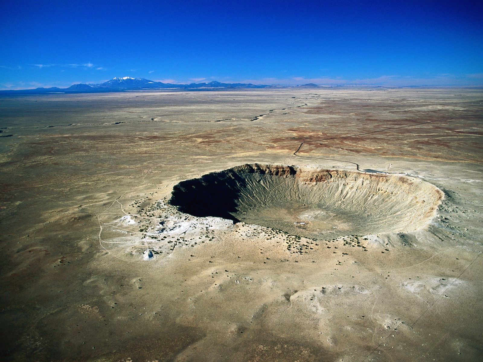 So you obviously can’t drive that far without planning a few stops on the way.
That’s a Big Hole
First up was the Meteor Crater ( www.meteorcrater.com ). It’s not very far from Winslow in the context of the day, but it was somewhere that Kas was keen on having a look at. Kev had been before, but it was 8 years previously, so why not go again?
After a little while it became obvious why not going again would have been preferable. Firstly, Meteor Crater is privately owned. That means that it is privately funded. Although the owners claim they maintain the best interests of the site there isn’t actually a great deal there. You can walk up to a viewing platform with various levels, from which you can peer into a hole. OK, it’s a big hole, but when you are half a day from Grand Canyon, there are better holes nearby. They have some of those telescope things which cost a quarter to use for a couple of minutes, but they don’t magnify enough for you to be able to tell what you’re looking at.
Then there is a large RV park, full of large RVs. And finally there is a visitor centre. For some reason, it seems to focus on space exploration. Maybe because there’s only so much you can do in trying to describe a hole. We didn’t bother with the film shows because we had already lost enthusiasm for the place.
There was also a café with a fairly limited selection of unappetizing looking snacks. And to enjoy this tremendously underwhelming experience you have to pay $12 each. Just as well we didn’t have a family in tow, we wouldn’t want to spend $50 for a place that kept us busy for a little over 30 minutes.
On the Road Again
Anyway, we bought ourselves the first ( but not the last ) big bucket of coke and hot-footed it back to the car to make as speedy an exit as we could possibly manage. I guess it’s not that it’s a particularly bad place. It’s just that compared to some of the NPS run sites we’d been to, this seemed like a collection of various mediocre attractions high price. You also feel that the money was just being used to expand the mediocre attractions instead of being used to preserve, develop and foster understanding of the monument itself.
 So next time I’m driving on I-40 through Arizona, and the kids want to go see the meteor crater, we’ll both just tell them to shut up, and drive straight past the place.
Dramatic Scenery
Once you get past Meteor Crater, you are approaching Flagstaff again. Whilst I said that the drive east on I-40 is a bit dull because there’s nothing to look at, the drive west is quite entertaining. There are some enormous extinct volcanic mountains just to the north of Flagstaff. You don’t realize quite how big they are because when you first see them you are a very long way away. You gradually approach them and they get bigger and bigger until you realize they are massive.
At this point you drive through a comparatively busy bit of freeway through Flagstaff, before heading back out into the countryside. As you pass Flagstaff you also change from dead flat, treeless desert to a few miles of what looks like high alpine scenery. There are a few hills on the road and it is suddenly surrounded by pine woodlands which block off the view. Eventually, you descend out of this bit and get back to more of the big wide flat desert, before reaching Kingman.

Plans are Made to be Changed
Just over a week or so previously we’d had our Saturday afternoon drive through Las Vegas. We had promised to go back to Vegas over the Hoover Dam and spend a night there properly. This would be where we would need to get off the freeway and head north to do that. In Winslow, however, we had decided we weren’t really that bothered. Going to Vegas would reduce the amount of time could have in Joshua Tree, as well as adding another 800 or so miles to the round trip.
So all we did in Kingman was to pull on to the forecourt of a gas station and eat lunch. Then we let out the Coke we bought at Meteor Crater to make room for another one. And we bought fuel. Anyway, enough of that. We’d not even done half the distance.
Our route to Joshua Tree involved ducking off the freeway just before the California border and driving down through Lake Havasu City. And then crossing over the Colorado at Parker Dam and following the one road across to the north side of Joshua Tree.
London Bridge is Falling Down
Lake Havasu City is home to an old incarnation of London Bridge. According to the book, the guy who bought it thought he was getting Tower Bridge. Sounds like a bit of a Sunday League error, so I’m not sure I believe it. But anyway, you have to stop and look at something like that.
We drove through apparently endless suburbs until we reached the centre and followed signs for the lake and bridge. We parked up and went for what proved to be quite a short walk. The bridge now spans a short stretch of lake between mainland and an artificial island ( well, it would be, because the lake is artificial as well ) which seemed to have a bunch of posh hotels. Having spent all day driving across a desert, it was strange to stop in a place with lots of greenery and people windsurfing.
 However, the problem with all that water is that it evaporates quite a lot, which means that the air humidity here is much higher than the surrounding desert, especially if you are very close to the lake. This basically means that your sensation of the ambient heat changes from “hairdryer” to “sauna”. You go from hot but dry to roasting/melting/cooking. This is quite a shock after a day sitting in the air conditioned car.
Down on the lake shore under the bridge it was truly hot. We elected not to stay for a drink or anything, it was just too hot for comfort. So we piled back into the air conditioned cocoon and pulled into the first available gas station for another 40oz bucket of Coke each and a tube of Pringles, before heading off south again.
Wot, no Wilderness?
The road south from Lake Havasu City was much more heavily populated than I expected. It follows the river down for most of the way, and there seems to be a lot of new building work going on. Maybe this is a favourite retirement area, where the weather is consistently dry and warm. Whatever the reason, there isn’t a lot of wilderness between Lake Havasu City and Parker.
At Parker we cut west and over the river, and so back into California. The road to Joshua Tree from here is basically dead straight for most of the way. It leads you across some proper desert again. It was quite busy by now, because this seemed to be a favourite route home for some of the Labor Day traffic. All going back to LA and other large cities in coastal California, I guess. So progress was moderate at best.
The road which looks dead straight on the map also has a lot of ups and downs in it. So although there are no curves, you can’t see far enough to overtake anyone. There is always another hill crest coming up. So it was a slowish amble behind an endless stream of RVs. The drive was also made more fun by the presence of a thunderstorm.
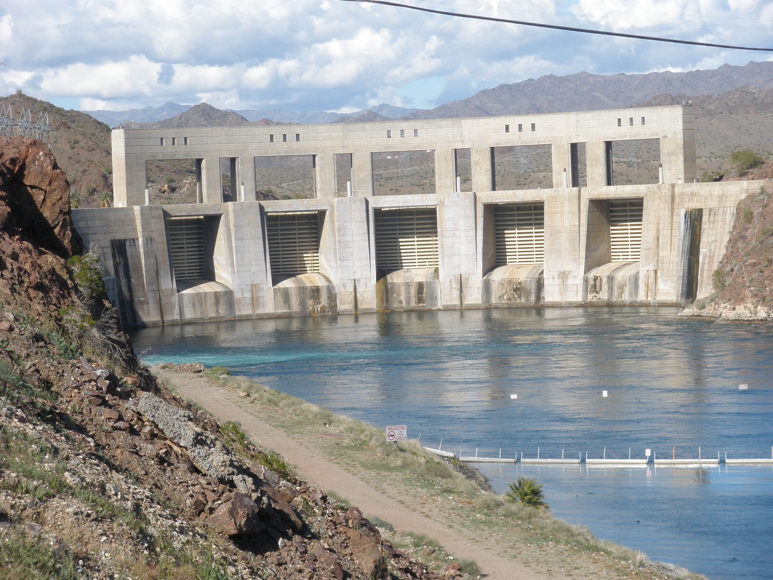
Twentynine Palms
At Rice we stopped briefly to dispose of the 40oz Cokes and we then progressed on towards our chosen stop for the night – Twentynine Palms. We arrived about 30 minutes too late to get into the National Park Visitor Centre, but at least their toilets were accessible, so some more of the 40oz Coke was disposed of before trying to find a hotel. I don’t think we had any particular plan, but we had developed a liking for the Best Western chain. There was a conveniently sited one near the western end of the town on the main highway, so that’s where we chose.
They had plenty of rooms, free breakfast and a pool, so we didn’t think about it for very long. In we go. We used the pool for a bit of relaxation just after we got there, and then headed off to find dinner. We both had numb minds after all that driving and Coke so we just pulled into the local Pizza Hut.
I think we caught them on a bad night. It was getting quite late when we arrived ( around 8:30 ) and it was a public holiday, so it was not the normal standard of jolly service we expected. They had run out of quite a few things on the menu, mainly the healthy options like salads, so we ended up with old faithful – pizzas and garlic bread. While we were having this, we got the distinct impression that the staff would like us to leave. They weren’t actively obnoxious, they just didn’t seem interested in our custom. So the meal was a rather fast and unpleasurable affair.
Still, no bother, because we both just wanted to get to sleep anyway.
Joshua Tree
Open the photo gallery >>
The Backstory
Joshua Tree National Park is one of those places you must go to if you’re a fan of U2, just because they named an album after it. Technically, I guess they named the album after the plant, not the National Park, but back at the plot, the album doesn’t have any songs about Joshua Trees themselves. That would be a bit weird.
 There is a photo of one particular Joshua Tree on the album sleeve that was taken with the band. That one is apparently miles away in the Mojave Desert near Darwin, California. They don’t want to tell anybody which one it was, because it would then be flooded by fan-mania and get trampled to death. So, somewhere in the Mojave Desert, there’s a Joshua Tree that U2 were photographed next to. In the Joshua Tree National Park, there’s a lot more of them, amongst other things.
On a previous trip to the US some of my friends recounted how they had visited the square in central San Francisco where they did a performance of “All Along the Watchtower” on the back of a truck which later got included on the Rattle & Hum album. I usurped this by going to the Red Rocks arena near Denver in 1994. The place where the Under a Blood Red Sky album was recorded. So going to Joshua Tree was a bit of a spiritual journey really, even though it doesn’t contain the “actual” Joshua Tree. It’s just one of those things you have to do, just so you can see what U2 were going on about. Except they weren’t really singing about Joshua Trees or National Parks. They are very strange plants, though. Joshua Trees, not U2, that is. U2 aren’t plants at all.
Back at the Plot
The Best Western in Twentynine Palms treated us to a free breakfast of pastries, cereals and coffee. And then we were off on our way to see what there was to see. The first thing to see, as ever in a National Park, is the main Visitor Centre. We picked up the usual collection of free papers, brochures, and snippets of useful information. The most useful piece of information here came from one of the Rangers. He told us that we would be well advised to plan to leave the park in mid-afternoon and return in the early evening. Why? Because we would find the temperature too hot to bear. OK, if you say so boss.
 We’d been to some hot places on this trip, so we didn’t really believe the guy, but we proceeded into the park with some caution nevertheless. From the Visitor Centre you basically drive straight up a long straight road until you pass the fee station. Then you are into some mountains, so the road starts to wind a little. You start seeing the trees themselves at around this point. We failed our initial park orientation because we couldn’t tell the difference between the Joshua Trees and the Mojave Yuccas. We just thought the Mojave Yuccas were baby Joshua Trees. However, when you get up close the difference is more apparent.
Remember the Rules About Water
First stop in the park was right over on the southern entrance at Cottonwood Springs. There is a moderately strenuous hike leading over towards the Lost Palms Oasis, which leads you through an excellent desert landscape of low hills with exposed rocks, sparse ( and spikey ) vegetation and not enough water. I think the Oasis is aptly named, because we seemed to walk for ages, but couldn’t find any palms. We eventually had to turn back for more water, as the normal allowance of 6 litres between us was running down quickly. It was hot there, and there’s no shade at all. Our plan on this holiday had always been to turn back when we’d drunk 2/3 of the water we were carrying. That had meant we missed a couple of objectives, and this was the latest of those.
 Having trudged back and swallowed loads more water we then drove back over the paved road towards the north entrance again. The hike had taken us around 3 hours, and lunchtime was approaching.
Not So Cuddly
We drove past the Ocotillo Patch turnoff, because Ocotillos don’t look that interesting from a distance, and then stopped at the Cholla Cactus Garden, slightly further north. Chollas are quite interesting. They are alternately known as “Teddy Bear” Cacti. They do, from a distance, look quite soft and fluffy, sort of like a plant made out of pipe cleaners and cotton wool. However, when you get close to them, you can tell that you really wouldn’t want to try cuddling them. The barbs on the ends seem to be able to jump onto your clothes, or any other part that brushes against them. This is how they propagate, I think. They don’t seed much, and normally when you see a stand of them they are, in fact, a set of clones from a single specimen.
Anyway, the slightest little brush against anything results in a whole crop of little barbs embedding themselves. Wear gloves, long trousers, long sleeves, and so on, and don’t take children close to them. They are very good for photography though. There is a short interpretive trail around this area explaining the plants and their roles in the local ecosystem. Quite interesting stuff.
Having seen the Chollas we decided that the ranger was right and that we really would like to go and lie down in a cold room for a couple of hours, so we shot off back to the hotel and had our lunch.
Photography Time
Suitably refreshed, we set off again at about 4 pm to have a look at some other parts. We went to the same entrance station and drove up the same road to look around some of the other stop-offs we had seen on the way past in the morning.
 We seem to remember a number of little stop-offs but can’t remember where they all were. Most were probably from the parks at White Tank, Jumbo Rocks or Ryan. At one, there is a rock formation called Arch Rock, which looks just like an elephant’s head. The was also Split Rock which, err, has a split in it. Another stop off resulted in us nestling under the bottom of a rock which also had a split in it. Somewhere near Jumbo Rocks, there is a rock formation right by the roadside that looks like a skull ( I think it is called Skull Rock ). All of these were interesting and very photogenic. If you can’t find anywhere good for a walk here, you can also just pull up by the roadside and take in a few sweeping vistas across a wide plain covered in the main event – the Joshua Trees themselves.
There are some pretty good specimens of Joshua Trees around here. If you want to do a reasonable copy of the U2 album sleeve photo you don’t really need the “actual” Joshua Tree, just ones that look similar. If you wait until sunset you could probably convince yourself that any one of them was the “actual” one. No two Joshua Trees look alike (or even vaguely similar), but they are all pretty weird and they all make good photos.
Sweeping Vista
We finished off the evening activity by driving up to the Keys View viewpoint. From here you can get a tremendous view down across the lower desert valley towards Palm Springs, and the mountains behind. You can also see the Salton Sea. And, if you know where to look, the San Andreas Fault. One of the main canals taking Colorado River water across into LA is below too. The whole effect is great, especially if you arrive just before sunset, as we did. As the sun descends in the west, you get some great colour transitions, from the yellows and whites of the day into softer yellows and oranges and then finally into reds and purples, before eventually there is just black with a few pinpoints of yellow street lights. The whole effect is well worth sitting through, and we weren’t the only ones doing so, even though the park had been quiet all day.

When it was suitably dark, we returned to our trusty RAV4 and headed back home. There was still time for a swift dip in the pool before getting ready to eat. This evening we chose a small family-run restaurant on the main road through Twentynine Palms ( name unknown ). It majored on serving substantial portions of typical American stuff – large steaks, salads, sandwiches, that sort of thing.
As usual, the food was good and the beer was cold and wet.
More Joshua Trees
Open the photo gallery >>
Another Day, Another Joshua Tree
A new day dawned, and a day filled with more Joshua Trees was in the offing. We began with the now customary free breakfast courtesy of Best Western, and then drove to the nearby mall for lunch items and more water. Always more water. And Pringles. It’s the two things most essential on any trip to the desert – fluid and salt replacement. So technically they’re probably somewhere between health food and a survival kit.

Fortynine Palms Oasis
We were feeling suitably refreshed and keen to attempt another walk, so we plumped for the nearby Fortynine Palms Oasis. The entrance to this area is just to the west of our hotel, so it was pretty quick to get to. We parked in a lot containing two other cars, and set off on our way over a hill. We didn’t really know what to expect or how long it would take. The walk proved to be one of the most rewarding of the holiday, not because of the drama, or the sweeping views, but because of the little things.
It was a walk through what we English would describe as “lumpy” hills – little ups and downs, nooks and crannies, small valleys and climbs. We were surrounded all the way by much the same. It was a quiet time too. I think we passed two families coming back (those whose cars were in the park when we arrived, presumably) but then no one else for probably 2-3 hours.
The really interesting thing about this walk was the nature. There aren’t big rocks, but there are a wide variety of plants that you pass by, and it is interesting (as an English couple) to see different types of plants nestling in their little habitats. The most striking was a variety of cactus which looks like a spiky red ball. At first we didn’t really realize what these were until we passed one quite close to the path. From then onwards we noticed them everywhere.
Count the Trees
We eventually rounded one corner on the path and saw some trees up against a hillside in the distance. These were the only trees we saw on the walk, and they looked like palms, so we put two and two together and guessed this was the oasis. It took a bit more time to walk to them, but we were right. I’m not sure what I expected at the oasis, probably some open water and an encampment of Bedouin, or something, but there were basically a few trees which had obviously found some water fairly close to the surface. There was no water visible anywhere.
We didn’t count the palms, so we took it on trust that there were 49 of them, but you do wonder what would happen if one died, or another started growing. Would the NPS engage in planting (or removal) to keep the number right, or would they change the name to Fortyeight Palms, or Fiftypalms Oasis, or would they just leave it as is, for the confusion of passing tourists? There is a danger in naming things after a number of trees, as the English town of Sevenoaks discovered in a particularly violent storm in the late 80s, when six of them fell over. Meanwhile, back at the plot, the oasis did have some good photo opportunities, especially for use of the recently purchased wide-angle zoom lens. These were quite large trees, and we were standing right amongst them.
 The walk back to the car was fairly uneventful and was very lonely. We got back to the car to find an otherwise empty car park. Hmm, must be getting too hot for anyone other than the English to be outside.
Time for a Break
So next we took a very short drive round to the Indian Cove campsite. The books said there were a couple of short hikes from the car park. We ended up just driving around the empty campsite and decided that nothing looked very entertaining. Anyway, it was rapidly approaching mid-afternoon and we felt lunch and a siesta coming on. Back to the hotel for us, then.
Driving Around
Later in the afternoon we were feeling a bit more lively and so headed off out again. This time we entered the park via the entrance station in Joshua Tree and sped round to the car park at Hidden Valley. This was apparently a popular place in the good old days of cattle rustling. The place has some history behind it. There is a reasonable length hike on a fairly good and flat pathway through the valley. It has an interpretive trail that covers some of the history but also the flora and fauna, so it’s worth doing.
Next we went round to Barker Dam for a bit more history. Again, there is a short interpretive trail and hike on level ground here. It’s good for passing half an hour or so.
Somewhere around here we bumped into an English couple in a car who appeared to be totally lost. They seemed to be driving around the park without any maps or guides trying to find the “good” bits. Hmm, the maps and brochures are free guys, just pop to the Visitor Centre…….
After this we decided we had probably done enough walking for one day, so we drove back through the park for one final glimpse and a few photos of Joshua Trees before leaving by the east entrance at Twentynine Palms.

Who Switched the Lights Off?
We returned to our hotel to discover that the power was off. Great news – no electricity means no light in the interior bathroom. So we had to shower and clean up by the light reflecting in through the window. It’s just as well it was a bit earlier than other nights and there still was some light. It also meant no air conditioning, which isn’t good.
It proved that the power cut was pretty localized because we headed off towards the centre of Twentynine Palms and discovered lights on everywhere. We ended up going into a Chinese restaurant, for a change, and it was pretty good. It also had a few other people in ( not many, but a few ) and this was the first real sign that anyone else was actually in Twentynine Palms. We almost had to wait for a table.
The power was still off at the Best Western when we got home. That meant trying to get ready for bed in complete darkness. The power magically came back on at some unknown point in the middle of the night. We were beginning to think we were jinxed. We’d spent a couple of weeks out in the desert and had been rained on, nearly hit by lightning, hailed on and encountered two power cuts. I thought deserts were supposed to be dry, hot and sunny all the time. Obviously not.
Freeway Frenzy
Waking Up to Reality
So far, we hadn’t really been thinking too much about the timings of anything. That changed on this morning. We got conscious of the fact that we now had just three nights left. In that time we had to get all the way from the south-east side of Los Angeles to San Francisco. That meant a veritable freeway frenzy across greater Los Angeles.
Neither of us fancied trying to do that in a short time. Anyway, we had the whole of the California coast to travel along. I think by now we had both decided now that we would spend the whole of the remaining time traveling back, rather than trying to do any more exploration into National Parks or other scenic areas. So we spent some time at breakfast confirming our plans, and setting targets. We wanted to set ourselves a base for spending that last two days going up the California coast. So we targeted Ventura as an overnight stay.

Look Away if you Love LA
Now, to those of you who have been to Los Angeles and like it, this may seem as if we were skipping through one of the best parts of America, if not the best. Doubtless Los Angeles does have plenty to offer, but we decided that we a) didn’t have enough time to do it justice and b) weren’t that interested in the tinseltown and theme park aspects of the city. Once you take away those parts, it’s just a big city, so we decided to limit ourselves to driving through the place.
We headed off from Twentynine Palms and followed Highway 62 west all the way round to where it joins I-10. We got out the Rand McNally detail map of Los Angeles and Orange County, and tried to identify the best freeway route through the city up to Ventura. It was the middle of the morning, so we were hoping that the traffic wasn’t going to be too heavy.
Isn’t It Big?
So our experience of Los Angeles was roughly as follows. Firstly, if you include all the suburbs and satellites, it is very, very big. Probably a hundred or so miles from the eastern satellites along I-10 to the western satellites like Thousand Oaks. It took a long time to drive through, even though we were moving at a reasonable speed the whole time.
And Busy?
Secondly, there are a lot of people there, and most of them seem to be trying to get somewhere else. Even though it was mid-morning, we were trolling along a complex series of 3, 4 and even 5-lane highways and the whole time I would describe the traffic as busy. Not heavy, but sufficient that you had to check the mirrors on both sides whenever you want to change lanes. There was no time on the whole drive-through where a lane change didn’t involve negotiation. Someone else always has to slow down or speed up to create a gap big enough for you to get in.
And Neatly Packaged
Thirdly, a lot of the famous bits are signposted, and sometimes visible, from the freeways as you pass through, such as the Hollywood Bowl, Hollywood Boulevard, the Downtown area, and so on. Convenient arrangement – you could almost feel as if you’ve been there without having to stop. However, we did have to stop when we found a particularly packed stretch of freeway through downtown, which had roadworks compounding the already heavy traffic.

But Somehow Still Confusing
And finally, the roads themselves. Angelinos have named all of their freeways, but the names don’t always tell you where the road is going. Some of the names also don’t follow the route numbers, so the “Donald Duck Freeway” might be I-10 at one point, and California-15 a few miles up. And many of the numbered routes merge with each other and then split up further on.
The names go in pretty much straight lines, but if you want to follow a route number you can find yourself trying to pick up numbers from the signs and making right or left turns at major junctions. I’m glad that we had the Rand McNally Atlas, and that there were two of us. One could watch the signs and shout out lane changes and turns to the other. I think Kas was driving on this stretch. She did very well to stick to the chosen route, continue at a fair speed and not hit anyone. I really wouldn’t have wanted to do that on my own.
Refuelling
Eventually we emerged into slightly lighter traffic and decided it was lunchtime. We needed both a fuel stop, and a drink. We pulled off into a shopping mall in Thousand Oaks, I think. There, we bought hot coffees from a local shop to accompany the sandwiches and Pringles that we had brought. They were left over from the Joshua Tree hotel fridge. Getting back on to the freeway in the correct direction proved challenging, but we got there eventually. And so we progressed on towards Ventura.
Ventura is a moderate-sized town in between LA and Santa Barbara. We decided to stay here partly to see whether there was any quick way to get to the nearby Channel Islands National Park ( www.nps.gov/chis/ ). However, although Ventura is home to the visitor centre, there isn’t much you can do unless you pre-book transport, so we didn’t bother. I doubt we would have had the time to visit anyway. We were only staying for the one night, and it was already 2pm when we arrived.

Killing Time
We had decided on the Bella Maggiore Inn as a stop-over for the night based on the write-up in the Moon Guide. This is an old Spanish colonial mansion built around a central courtyard. It was an excellent place, full of character. We got a smallish double room facing in towards the ( now covered ) central courtyard. The room had a balcony view over the courtyard.
We decided to have an afternoon of doing very little, so we went up to the local shopping mall and wandered around for a bit. Once you’ve been to one indoor mall you’ve been to them all. It’s a building full of chain stores and little boutiques. It could have been anywhere. Kev got a new watch strap in Sears, but that was about it. Not a very exciting afternoon.
When we got back to the Inn we parked up and went for a stroll up the old main street in Ventura to try to identify somewhere for dinner, and to get a nice coffee. It is like my mental picture of a small-town America main street, with a selection of 2-3 storey buildings containing a mix of family-run shops and restaurants. It’s worth a walk up and down here. We decided that if we ever win the lottery and don’t have to work any more, we might consider Ventura as a place to relocate.
Dinner Time
For dinner, we decided on a place that did half Thai and half Peruvian. Sounds like a bit of a funny mixture, and so it proved to be. The food was fine, but the atmosphere was a bit strange and it proved to be the first place we’d visited which wouldn’t accept a traveller’s cheque in payment. Every other place we’d tried this was more than happy to treat an Amex Traveller’s Cheque as if it was cash. So we ended up having to pay on a credit card, which left us feeling a bit peeved.
Highway 1
Open the photo gallery >>
Beginning the Day
 The breakfast at the Bella Maggiore was extremely good, so we left in a good mood and with full stomachs. We hadn’t really decided where to go or what to do on this day. The whole thing was a bit hit-and-miss. The Grand Scheme was to try to drive up Highway 1 to get a bit closer to San Francisco.
Santa Barbara
We started by driving into Santa Barbara. After some time of getting lost on one-way streets we eventually arrived at a big open plaza which is alongside the old mission from which the town gets its name. We didn’t have any loose change to pay for parking so we didn’t stop. Instead, we drove up a hill behind the mission and visited some botanical gardens instead. This had a fairly interesting selection of native and non-native plants, and the walk round kept us occupied for a couple of hours. However, our hearts weren’t really with it, so we had a quick lunch and headed further north, to see how far we could get towards Monterey.
Heading North
The drive north of Santa Barbara was a bit dull. You leave the coast and pass by a number of unremarkable towns, each of which seemingly has its own bizarre claim to fame. San Luis Obispo was home to the first-ever motel. Gilroy is the world’s garlic capital ( and you can smell it as you drive past ). San Simeon is home to the Hearst Castle ( www.hearstcastle.org ), which is apparently California’s second busiest tourist attraction.
 We stopped at Hearst Castle for a little look around, but once we saw the entry prices we decided not to bother. It’s quite expensive to get into, and I don’t think either of us was that interested anyway. So we just had a very expensive cup of bad coffee in the main visitor centre, and then returned to the car.
The Famous Bit
From San Simeon, the road north towards Monterey is the famous part of California State Route 1. This is famed for being the most beautiful piece of coastline in the world. I’m not sure about that, but it is pretty dramatic. The road really does stick to the coastline pretty much all the way for the 80-100 mile journey, apart from a brief trip inland to go through Big Sur.
As the coastline is an alternating series of headlands and valleys and is quite steep-sided, you are constantly turning and going up or down. This was the only part of the holiday where I decided I didn’t like the RAV4. The suspension just seemed a bit dodgy and after an hour or so I was starting to get distinctly sick. We made a couple stops at likely looking pull-offs and took a few photos. The road was quiet and the weather was very good, so we weren’t in any particular hurry to finish the drive.
Pacific Grove
By the time we arrived in Carmel, the afternoon was starting to look very much like evening. We liked the sound of a couple of the motels in Pacific Grove, so we picked our way through the various little towns of Carmel and Monterey until we got onto another traditional American main street in Pacific Grove. At the end of this were the motels we were interested in.
The first place we tried was the Butterfly Grove Inn. This looked best from the Moon Guide. The rooms they had available were very good, but were also much more expensive than the book hinted. The cheapest they had available was around $150 a night, which seemed a bit lavish. So we went straight over the road to another motel. We can’t remember the name, but it may well have been the Seabreeze Inn. Anyway, the rooms looked OK and we were getting too tired to argue. So we checked in for our last two nights in the US.
We were both getting a bit hungry as well, so we had a quick shower and got ready to go out for the evening. The one quirk of the motel room was that we couldn’t get the shower to switch off. The tap was very stiff, and despite our best efforts we just couldn’t get the flow to stop completely. So it’s just as well that the noise of running water couldn’t be heard from inside the room because of the air conditioning. We did report this to the reception desk, but they never did fix it while we were there.

An Evening Stroll
We decided to walk down into Pacific Grove rather than take the car. This was partly because we had been in the car for most of the day, so we wanted to stretch our legs, and partly because it was only a mile or so, so we decided we could safely both have a couple of drinks and walk home rather than risking a drive whilst under the influence.
We got down into Pacific Grove to discover there was some sort of convention of 1950’s/60’s cars. There were loads of very well-turned-out examples belonging to a wide variety of people. I won’t try to list the various models because I don’t know my American cars at all, but most were very much from the days when cars were big and showy, with massive engines and various sticky-out fins and other bits.
We ended up eating in an Italian restaurant on the main street. The food was good and the restaurant was very civilised but we got ripped off over the house wine. It was considerably more expensive than many of the bottles on the menu. In Europe, house wine is normally a euphemism for the stuff you put in your car engine to stop it freezing up in winter. You expect it to be considerably cheaper than anything which arrives in a proper bottle.
Never mind, you live and learn.
Monterey
Our Last Full Day
Our final full day in the USA. We had decided that it would be a good day for doing as little as possible. So we planned just to look around Monterey and do lots of eating, drinking and relaxing. We started with breakfast at a local family-run place on the main street through Pacific Grove. I can’t remember the name, but it was pretty average, so not much more to say really.
 We then took the car back to the motel and decided we were going to walk along the coast down into central Monterey, if we could manage that far. So we headed through a couple of blocks of houses until we reached the coast, and turned east towards Monterey. The weather was bright and sunny but there was a distinct chill in the air. I don’t know whether this is usual for Monterey in early September, but it was quite refreshing after weeks of scorching temperatures.
Walking Along the Coast
The walk was quite varied, with some stretches where you are right on the sea side, and others where you cut inland a little to walk through shops and round waterfront buildings. I believe this is a part of the famous 17-mile drive. It was well paved, flat and easy-going. We just ambled along and watched the folks going by and coming the other way, everyone just doing everyday things.
 We eventually found the centre of Monterey by cutting inland slightly, and were fairly unimpressed. It is the centre of a moderate-sized town, and has what you would expect, a few hotels, a few shops, and a few cafes. We stopped in one place which was both bookshop and café, and had a quick latte and read the local newspapers.
When we left here, we immediately got caught up in a bit of a crowd milling around on the street. We heard the sound of marching bands approaching. So we decided to stay put and see what was going on. I’m still not sure what the event was, but it had a selection of floats, marching bands, the local police and fire departments, and lots of local people dressed in a variety of costumes. I’m sure there must have been some greater purpose to the whole thing, but we weren’t aware of it. Not that we really cared, it passed the time for a while.
Lunch O’Clock
By this time, we were both getting hungry again and decided some lunch was in order. We ended up in a small bar that had outside seating and which brewed its own beer. The beer was definitely cold and wet. By the time we’d had a nibble and a couple of beers we were feeling distinctly drunk, and also distinctly relaxed.
 We decided to return the same way we came, except this time we a) needed more restrooms and b) kept stopping on the way for a rest. We stopped at a small beach for 10 minutes and watched the locals relaxing. Then we stopped in a small shop selling general novelty items and tourist tat. We searched in vain for someone selling ice creams. Eventually, we were back near home so we skipped the ice creams and crashed in the motel for a while.
One More Mexican Meal
We then got up, cleaned up, and walked down into Pacific Grove for our final dinner in the US. We spent a good half hour wandering up and down the centre of Pacific Grove trying to decide on what we wanted. Kev then suggested one final Mexican to finish the holiday, and we spent another half hour or so wandering around trying to find a Mexican restaurant. Pacific Grove must be the only place we went to in the US that doesn’t have Mexican restaurants on every corner.
 We eventually found one, though. It was pretty close to, but just off Lighthouse Avenue, and so I think it must have been Peppers Mexicali Café at 170 Forest Avenue. It was an absolute gem. We had to wait a few minutes to get a table, but this didn’t stop us from getting a beer. Once we did get to sit down the food was terrific. We had lots of chips and beer and then some main courses. It all proved to be both substantial and very tasty. This was probably the best Mexican food we had eaten all holiday, and that is saying a lot. So all in all this was the perfect culinary experience for us and we whiled away the evening talking about all the great places we had been, and which ones we’d like to go back to some day.
Coming to a Close
It was during this meal that we both finally were hit with the fact that the holiday was over. All that remained was to drive back to San Francisco and fly home. This caused the expected amount of sorrow, and we felt obliged to drown the sorrow with some more beer, as you do.
We made our final walk along Lighthouse Avenue up to the motel and fell into bed. We’d already sorted out most of what we needed to be handy for the following day.
The Final Leg
Time to Pack Up
And so came the day that comes at the end of all good holidays. The final leg. The day where you have most of a day to kill before your flight home. And no particular enthusiasm for doing anything. The one where you talk a lot about what you’ve been doing instead of actually having another day of doing. The one where it hits you. The end-of-holiday blues were beginning to settle in.
 We had decided if we set off early enough we could have time to scoot into central San Francisco and do a bit of final shopping and have a nice breakfast. Our flight wasn’t until early evening, so we weren’t in any great hurry to get to the airport. We got up fairly early and headed off. After a brief stop in Monterey for fuel and coffee we headed up the main road towards San Francisco. It proved an interesting drive as there was some early morning mist rolling in off the Pacific.
Driving North
I remember turning on the car radio and listening to an America’s Top Ten with Casey Kasem, or something similar. One song really stuck in my mind, “1000 miles” by Vanessa Carlton. I guess because it’s a bit sad and very American. It kind of summed up the mood I was in at the time. To this day I can’t hear the song without thinking of the holiday, and specifically that Sunday morning drive. It didn’t seem to be very long before we were in the southern suburbs of the Bay Area and heading up the freeway towards the airport. It was early so we passed straight by the airport and headed for downtown San Francisco. We parked up under Union Square and went for a walk around.
A Repeat Breakfast
We went back to the café where we’d had breakfast twice at the start of the holiday. They still served some very fine homemade granola, double chocolate muffins with extra chocolate and traditional American coffee.
 We then went to the shop where Kevin had bought his new wide-angle zoom lens at the start of the holiday. It had not been functioning properly. I think the internal software was not compatible with the camera body I was using. This meant I had been unable to use any of the manual programme settings on the camera. As a result, most of the photos taken with this lens looked a bit washed out. I could probably have sent the lens off to Sigma when I got home, but I felt more inclined just to change the lens.
Thankfully the man in the shop was very nice and agreed to take the lens back. I swapped it for a more expensive Canon branded one. He didn’t really have to do this because I had been in possession of the thing for 3 weeks ( and it was looking a bit grimy ). But he took it anyway and I paid him the difference between the Sigma and the Canon. The Canon lens worked perfectly straight away, and although I had paid him in total the same amount of money I would have paid for this lens in the UK, I at least got a good quality functioning lens, so I left feeling that I had got a reasonable deal.
Off to the Airport
And so back to the car again. It was still only a little after lunchtime, but we had really run out of enthusiasm by now and just wanted to get on our way. We got up to the airport in no time and found the car rental return quickly. They were perfectly happy to accept the car as it was, despite the fact it had changed colour from white to desert red. This was probably because we’d paid for all the upgrade insurances, so we could have just deposited a pile of twisted metal and it would have been covered. Anyway, they got us bussed up to the terminal quickly and we checked in.
 We were very, very early and had about 3 hours to kill in the airport. San Francisco isn’t the largest terminal I’ve been to and the shopping didn’t last long, so after walking to one end and having a coffee, we walked halfway back and bought a couple of souvenirs for our friends James & Emma who had been looking after the house for us. We then settled down in one of the hotel bars and began to work our way through our few remaining cash dollars. We had enough for a couple of beers and a couple of cokes each, and plenty of time to drink through them.
Time for Sports
The bar is one of the ones which shows sports on big screens, so that the punters have something to do and something to talk about. It stops you getting depressed while waiting for your plane. On this day, we got the twin delights of watching a San Francisco Giants game on one screen, and an English Premier League game from the previous afternoon on another. We can’t remember who the Giants were playing, but the Premier League game was Liverpool vs Newcastle Utd.
 We’d never watched English football with an American commentary before ( or since ) and it was a little weird. The commentator had the strange opinion that the English season on his channel didn’t really start until they’d been to their first game at Anfield. This is a strange notion for we English (unless you’re a Liverpool fan). They hadn’t been the best team in England for many years. Nevertheless, it proved to be the typical Liverpool / Newcastle encounter with lots of enthusiastic tackling.
Bye Bye
And that was it. The flight home was uninteresting and uneventful in the way that a 10-hour flight should be. The car was where we had left it 23 days before, and it started the first time. The drive home was uneventful. When we got home we had a massive pile of laundry to do, and a bucket load of films to get developed. You have been looking at some of the photos as you’ve been ploughing through this diary.